
Introduction
During 1884, eight articles were published in the Sydney Mail and New South Wales Advertiser, written by a Sydney based yachting correspondent, who called himself ‘Selvagee’.
He wrote about a three-week sailing trip from Sydney to Bulahdelah, via Nelson Bay, Tea Gardens and the Myall River, and later return to Sydney via Newcastle and Lake Macquarie. The touring party undertook the journey from Sydney to Nelson Bay, (and return to Sydney) in a cutter named ‘Bandicoot‘. The balance of the trip from Nelson Bay to Bulahdelah, via the Myall River and lakes and return was undertaken in a skiff equipped with both oars and a sail.
The eloquent stories of the excursionists, as outlined in the newspaper extracts presented below, provide a comprehensive description of the various landscapes and sparsely populated areas they passed through, and of their recreational pursuits along the way, such as shooting wildlife and fishing. The Myall River and Lakes were little known in Sydney around 1884.
Only sections of the eight articles that relate to the Port Stephens and surrounding areas are set out in this paper. Many of the place names referred to in the articles are no longer used.
Sydney to Port Stephens by Cruiser
The Sydney Mail and New South Wales Advertiser, of 4 October 1884, page 668, reported:
‘My sole reason for chronicling an uneventful trip, ….. is to introduce yachting men to the Myall Lakes, a district known to very few of them, and to the waters about Port Stephens, the Broughton Islands, and the Seal Rocks, and to give them a peep at Lake Macquarie on the way back. …..
The Bandicoot is a stout little vessel, measuring about seven tons, in dimension 150 feet overall, by 9 feet beam, and drawing 5 feet of water with five tons of ballast (a ton of it being bolted on the keel); and when we put to sea on the present cruise I should be sorry to say how many hundred weight of gear and provisions were on board. She is cutter-rigged and was built by that honest old artist the much lamented “Billy Langford,” as he is still affectionally known by old friends, who have not forgotten his untimely and most cruel death.
The Bandicoot was designed for a cruiser, not a racer, and being intended chiefly for getting in and out of shallow inlets, like Lake Macquarie, Cape Hawke, &c., was originally a centreboard vessel; but latterly her owner has taken the centreboard out of her and added some extra keel in lieu of it. She has not much headroom under deck, but this deficiency is amply compensated by a large open “well,” with seats all round, which in fine weather is a great comfort, and in foul when decked over with strong hatches and canvas hatch covers, is safe and snug. The dinghee [small boat] goes into this well in bad weather or rough water, but as we did not take the dinghee with us, the cabin was all our own to promenade, eat, navigate, think, and sleep in. …..
A fine roomy 20-foot centreboard skiff [row boat] had been despatched on a ketch to Nelson Bay, the first decent anchorage after passing the heads of Port Stephens, about a week before our departure. This boat was to be our conveyance up the Myall River to the Lakes, which it was our intention to explore. …..
So, everything being ready for a start, the Bandicoot got under way from Ravenous Bay [in Sydney] early on Saturday morning, December 22, 1883. The boys had slept on board the night before, and we were thereby able to make a virtuous beginning. There was no wind when the mooring rope was cast off, and the buoy dropped over the bow, so the sweeps were put in requisition, and the Bandicoot, was persuaded out of the bay into the fairway, where an ebb tide and a light air from N.E. were found; but the air was so light that it was near noon before we had got clear of the Heads…..
Next morning, Sunday, all hands were up at daylight, and long before breakfast was thought of, both anchors were aboard and stowed away, and with a slashing breeze from the south-ward, the little ship was soon abreast of Mount Eliot, the curiously-escarped island lying in the bight of Broken Bay, which everybody compares to a lion couchant, though I must own I never was able to detect the resemblance. ….
After passing this remarkable headland (it is one of the great Circumnavigator’s names, as are Broken Bay, Mount Eliot, and so many other well-known localities on this coast) the sea was a little smoother. We had left the strong tide rip of the Hawkesbury, which is nearly always at loggerheads with the wind or the current at its mouth, and the snug little boat-harbour of Terrigal soon hove in sight, with Cape Upright or “Terrigal High Land,” as the coasters and fishermen call it, bounding the horizon to the northward. …..
The Sydney Mail and New South Wales Advertiser of 11 October 1884, page 720, further reported:
‘The Bandicoot’s kitchen …. consisted of a copper cylinder on a stand, with a sort of false bottom halfway down for the support of pot, billy, or pan, a grating for the fuel, with a door to feed it and holes perforated in the sides for the draught, a drop-handle to carry it by, and a stout metal tray to stand it in. …. This stove, with all its accompaniments of pots, frying pans, fuel, &c., is stowed away in a special sea chest in the wing of the yacht, so that no one need be for ever stumbling over the cook’s gear, as is sometimes the case in big yachts defectively appointed for cruising purposes.
Eight o’clock found us abreast of Terrigal High Land (Point Upright of the charts), and with breakfast underway, …..Then out went the reefs in the mainsail, up the topmast, and away we bowled along across Tuggerah Bight, and shaping a course so as to pass to seaward of the bumborers [bomboras] which lie about three miles off shore, and about N.N.E. from Point Up-right. ….
After passing Catherine Hill Bay we easily made out the entrance to Lake Macquarie, with its little green breakwater, called Moon Island by the white man, but by the “natives” Creen Island. On the old charts this entrance is named “Reid’s Mistake,” after some unfortunate Reid of bygone years, whose immortality rests on his having mistaken this place for the entrance of the River Hunter. From Creen Island we soon reached along the Red Head beach, and passing Shepherd’s Hill, and the forest of tall masts which peeped out above the neck of land which connects Nobbys with the mainland, and stood for our great coal port, Newcastle, which let every yachtsman shun if he values his temper and his vessel.
At 3 o’clock we were off Newcastle and making little headway with a light breeze from N.N.E., and a swirling southerly current; but Newcastle is not the port for me to run into voluntarily merely for the sake of escaping a night at sea. So, we piped all hands to dinner and stood out for a long leg to the eastward. ….
At 5 we tacked and stood in, hoping to weather the northern headland of Newcastle Bight, Morna Point, distant some 18 miles from Nobbys (Newcastle), and off which lie some nasty patches of rock, on one of which the Telegraph got stuck fast, and in return gave it the name of “Telegraph Shoal,” by which this danger has since been officially known to seamen. It is a good direction to all vessels, and especially yachts, to keep clear of Morna Point. Steamers bound northward were once in the habit of shaving it very closely to keep out of the southerly current; but the risk is not worth the candle.
We stood in to about a mile from the tail of the shoal, and then tacked to seaward again for another leg to the S.E., the wind being then about east, and falling very light. It was dark before we went about and stood in for Port Stephens’ Light, a very fair coast-light, revolving and showing out white and red alternately in short intervals and, according to the “Coaster’s Guide,” visible in clear weather from a ship’s deck at a distance of 17 miles. Between Morna Point and Stephens’ Point, the long, low, projecting headland on which the lighthouse stands, the coast is low; and rugged, and off Point Stephens there is a reef which must be shunned by any vessel steering for the port. A berth of half a mile is, however, quite sufficient for that purpose.
Before nightfall the position of Port Stephens was pointed out to us in an unmistakable way, and by magnificent natural beacons. We could plainly distinguish that superb porphyritic sentinel, Yacaaba, lifting his sheer front some 900 feet out of the sea, on the north, and on the south of the entrance, Toomeree [Tomaree] performing the same function, but boasting only half the elevation of his brother. Then, as if two such splendid monoliths were not enough to mark this harbour, Cabbage Tree Island (so called from the palms on its western slope) and Boondelbah Island, (and a tiny islet called Little ) do duty as an independent series of beacons east and north-east of Yacaaba, while the outline of Long Island [Broughton Island] , some three leagues distant, cuts the northern horizon.
From this it will be seen that it is impossible to make any mistake about the locality of Port Stephens; but it is a fact that the light was placed in its present position to prevent vessels from doing what several had done before, to their utter ruin— mistake False or Fingal Bay, immediately south of Stephens’ Point for the entrance to Port Stephens. False Bay is separated from Fly Roads anchorage, just round the lighthouse, by a strip of sandy beach, submerged at high water, and known as Narrow Gut. Fly Roads, so called because H.M.S. Fly many years ago, when surveying this part of the coast, often made use of it as an anchorage, are very convenient for vessels meeting a heavy westerly or south-westerly wind in attempting to beat up to an anchorage in Nelson Bay. …..
We stood in to within a good mile of the light, and then, strange to say, found a heavy fog obscuring the entrance, so, thick that both Yacaaba and Toomeree were only faint shadows. Meanwhile the sea had been making not only visibly, but sensibly, and, on the whole, it was thought better to heave round again to seaward and wait for the fog to to rise. The fog did rise, and so did the sea, and the wind, and by the time we were about five miles to the eastward of the light, the Bandicoot, with all reefs down, single reef in the foresail, and spitfire jib set, was doing, treadmill work over as nasty a jobble as any 7-tonner ought to be in. …..
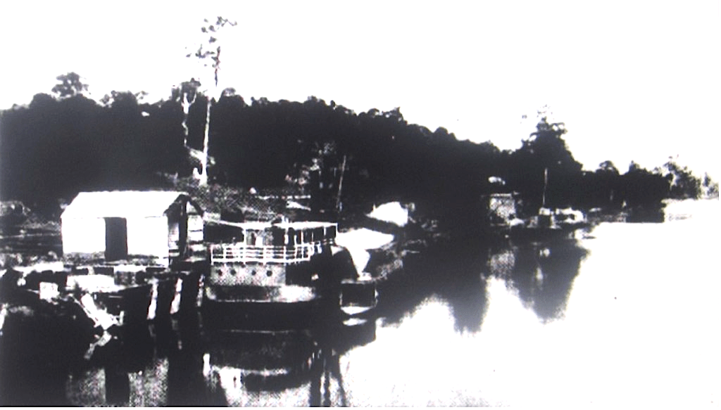
As to me, I had turned in and must have enjoyed nearly an hour of real “sea-boys’ sleep,” when I was summoned on deck by the quartermaster reporting broad daylight astern, and the Port Stephens’ light dead ahead, distant about one mile. Thereupon, having rubbed my eyes, I exasperated the rest of the crew by calling them, so that they might not die without having seen the entrance to Port Stephens at sunrise. They saw it and we ran rapidly, past Fly Roads, and round Toomeree, through the heaving jobble which is nearly always found between these heads; and then, passing the shoal-ground off the last named headland (always steer in, to as to give this shoal at least a good cable’s length of respect), we ran by Nelson’s Head, where there is a harbour light, a telegraph station, and a flagstaff, into the smooth water of Nelson Bay, where, not a little fatigued by our night’s work, we dropped anchor off the Fish Company’s pier, as it is called, and found W. Hollis, the fisherman, waiting to welcome us, and announce that the skiff had arrived safely per ketch Daisy.
Pier of the New South Wales Fish Company at Nelson Bay, with the ‘Prince of Wales’ in the foreground [Australian Town and Country Journal, 5 February 1881]
The beauteous panorama of Port Stephens harbour viewed from Nelson Bay interested the boys certainly, but not so much as breakfast on that early Monday morning. So, having launched the skiff, cleaned down the yacht, and made everything snug and tidy, we started culinary operations, which having had a successful issue, were pleasantly followed up by a general desire for a good long siesta. The heroic element in the boys’ appetites had already begun to assert itself, and as to the siesta— did ever man or boy more deserve it?
I despatched a telegram to certain anxious parents in Sydney, and to a certain other person who I knew would be pleased to know of our safe arrival; and then, after strolling over the defunct Fish Company’s works, turned in myself, and enjoyed the deep which needs no “choral.” And there ended the cruising part of our trip to the Myall Lakes.’
Port Stephens to Bulahdelah in a Skiff
The Sydney Mail and New South Wales Advertiser of 18 October 1884, page 799, reported:
‘After spending four days (would that they had been forty!) exploring the western end of the harbour, fishing for schnappers outside and for lobsters with the fishermen at Cabbage Tree, visiting a most genial monarch, the King of Port Stephens, at his royal seat of Tahlee, visiting George Button, Esq., and other delightful aboriginals, whose names and additions I have forgotten— visiting the ruins of Tanilba House (oh what a wreck !), Cromarty Farm, Cabbage Tree, or, as some prefer to call it, Schnapper Island, lying between Tanilba and Tahlee; and many other spots which had for me that ineffaceable charm which is created by old associations; after all these visitations, I say, we finally determined upon a scheme of exploring the lakes, and, on Saturday, December 29, put it into execution.
We left the Bandicoot moored off the pier stem and stern, and duly hatched and tented over, under the care of a neighbourly fisherman, and, after amply providing the skiff with fresh wafer (in breakers), and such provisions of a portable kind as we hoped might suffice for an absence of two or three days, with plenty of munitions, of war for possible campaigns against both fish and fowl, we finally made a start from the bay at half-past 6 one fine Saturday morning, and as we ran across the harbour with a fine westerly breeze past the sand patch, which is nearly always covered with seabirds, from the pelican to the sandpiper.
Will made an extraordinary shot with his Henry rifle. A column of pelicans lined the edge of the patch, as usual, immersed in thought and digestive operations, and slowly taking wing as we got within range (about 200 yards) presented a sort of flying perspective to the enemy. “Ping,” rang the Henry, and down fell three of the birds, one dead, the others winged. Then ensued a chase under sail, which I shall not be likely to forget. Of course, it ended, after nearly an hour’s hard work, in the capture of the wounded birds, which I may as well explain were wanted for zoological purposes; otherwise, those grotesque yellow eyes and ponderous bills and everlastingly elastic pouches would have haunted us for many a long day.
The quantity of fish we found in the stomachs of these creatures in various stages of assimilation was simply prodigious. One contained at least two dozen whiting of various sizes, together with small fry of sand mullet and garfish, nearly sufficient for a day’s schnappering. Truly they must be terrible consumers of young fish. One pelican must be as bad as a dozen shags. After this taste of his quality with a rifle, I began to entertain a great respect for my chief officer. The boss was once considered, a very tidy performer with a small bore; but he never in all his life brought down three birds with one bullet.
After the pelican episode we ran along to Myall Point as quickly as our wings could carry us, and entering the Myall River found that the flood tide was still running up strongly. Passing a quantity of ballast heaps— stones thrown out by the coasters passing up to the various sawmills for their freights of sawn-stuff, and constituting a most dangerous nuisance to the Queen’s Highway, we ran along to Windy-wapper [Winda Woppa] — a name width I never saw in print, and, therefore, am somewhat doubtful of my orthography,— and by Anderson and Davis’s sawmills (all on the river bank) up to a little village known as “The Tea Gardens,” but why so known nobody has ever been able to enlighten me. ….
A Government dredge had been scooping away on the flats above the Tea Gardens for some months before our arrival, cutting out a permanent passage, it is to be hoped, for punts and other vessels plying between the Upper Lakes and the Tea Gardens; but the work is a very tedious one, and it is impossible for the dredge to report much progress. The Myall beyond this point loses itself in mangrove islands— at least they are islands at low water for several miles, and the channel is very narrow. However, we managed to beat up it for a few miles farther; but when the river began to close in to a width of 100 yards or less, sailing, although in a very weatherly centreboard skiff, became too slow. …..
A short distance from the Tea Gardens we met with the Government dredge and its accompanying barges, and a small steamer lay helplessly stranded, but safe and comfortable, high up among the mangroves. The crews were demonstrating somewhere or other or enjoying their Christmas holidays, for not a soul was visible. This was something of a disappointment, for the truth is the boss rather wanted to ask his way, not having visited the river for upwards of 12 years, and fearing to miss the right channel among the innumerable creeks which intersect the flats at this point. Of course he took the wrong turn, and meandered about, first in one channel and then in another, for a couple of hours. But it came out all right, and we entered the main river suddenly after punting up a channel not much wider than a boat’s length, under swamp oaks covered with creepers and festooned with a multitudinous drapery of all sorts of vines.
A couple of small squads of black ducks rose with the sonorous quack which the sportsman sometimes loves and sometimes hates to hear (it depends on circumstances), and three or four cock redbills sprang out from the rushy islets as we brushed by. At the point where we entered the main river a blue crane jumped off an over-hanging swamp oak, with what I suppose must in the language of cranes have been the equivalent of an oath, levelled at the disturbers of his meditations, and immediately afterwards about a dozen black ducks, as if responding to the crane’s warning, dashed away helter-skelter up the river, pursued by the anxious hopes of better and nearer acquaintance on the part of some of the skiff’s crew.
We had now rolled off about 10 miles from Myall Point, and as the sun began to get rather too intensely personal we unshipped the mast, and set the awning, a pleasant roof of double twill, extending from tuck to stem, under which we were happy and cool, and could labour away under a meridian sun as pleasantly as possible. The plash of the oars in the ample stream— we were now in the full width of the river— gave timely warning to many a little family of wild ducks, and now and then alarmed the too vigilant cockatoo perched on some commanding tree.
But there was no time to squander, so we pushed on, not until we had spent a quarter of an hour of invaluable time in a fruitless effort to kill a shark which had nearly stranded himself on one of the shallows, doubtless intent on the chase of some too seductive flat-tailed mullet. He seemed about eight feet long, but, withal, very slim, and was trying to make good his way in about 18 inches of water. The country hereabout on both banks is a dense jungle of swamp oaks and cabbage-tree palms, the river still about 80 or 100 yards wide, and generally deep enough for a small ship to navigate, until a small lake called Grasswater is reached, with beautifully green; reedy banks, the bottom covered by duck-weed, or something much like it, and swarming with fish (chiefly mullet), which darted in and out from their weedy haunts as the skiff passed over them.
The water here was evidently anything but the pure “briny,” for many lacustrine plants were flourishing on the edge of the river. At the northern end of Grasswater there is a curious eruption of basalt, and the magnificent vegetation flourishing in its decay attests the presence of a splendid soil by towering palms and immense fig trees, all interlaced by vines of the thickness of a rattan, but apparently as endless as the sermon of a popular Baptist preacher. The same vine is found on all the Northern rivers and is probably a species of “loya.”
We had now reached (after passing through Grasswater) a sort of champion country, at least on the left bank of the river. For miles and miles there was a dead flat, bounded only by the range far away westward, and covered by a growth of broom and grasstree springing from a soil as black as your hat, with a strange sort of varnish on it, but all evidently almost as sour as the sea beach. The sourness is probably the result of dead flatness; there is no drainage, and the floods of winter have little or no outlet. Many a time on these plains I have rattled up an emu as I walked along in quest of quail or wallaby. …..
The soil on the right bank (the eastern) seems capable of producing anything if it could only be drained, which is practically impossible, for the fall is very slight, almost, imperceptible. At present it produces only palms and swamp oaks (until you approach the next lake, the Broadwater) and vines, and the vegetation common to swampy or inundated land.
Every now and then the river breaks through its confining banks, and spreads a marshy, reedy swamp over a few acres of low ground, sacred to coots, wild ducks, and redbills, and to innumerable reed finches. About a couple of miles from the point where the river emerges into a splendid lake about six miles long by three wide (the Broadwater), the flooded gum began to make its appearance wheresoever the banks were a little above flood level.
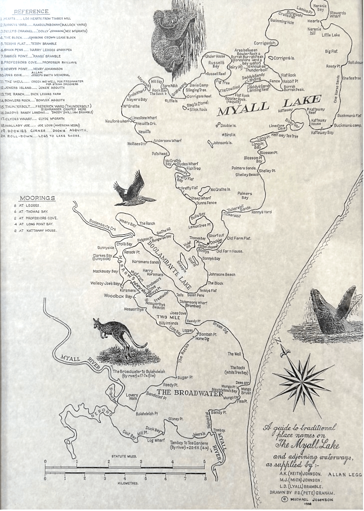
Map of traditional place names on the Myall Lake and adjoining waterways. Drawn by P. D. (Pete) Graham. [Prepared by Michael Johnson, 1998, and on display at the Inner Light Museum, Nelson Bay]
And here at Tamboys [Tamboi], as the place is called, we shoved the skiffs nose into the bank and went ashore to dine. One may as well use sumptuous words although the dinner was only cold beef, damper, pickles, and quart-pot tea. But what matter the elements when the appetite is supreme? At Tamboys the Harbour and River Department has done some useful work for the purpose of making the south end of the Broadwater navigable. The prevailing north-easter, aided by the winter floods, had almost closed up the navigation at Tamboys. By a series of stone dykes, a passage available for anything drawing about three feet of water has been established, and I suppose the dredge will for the future keep it at that.
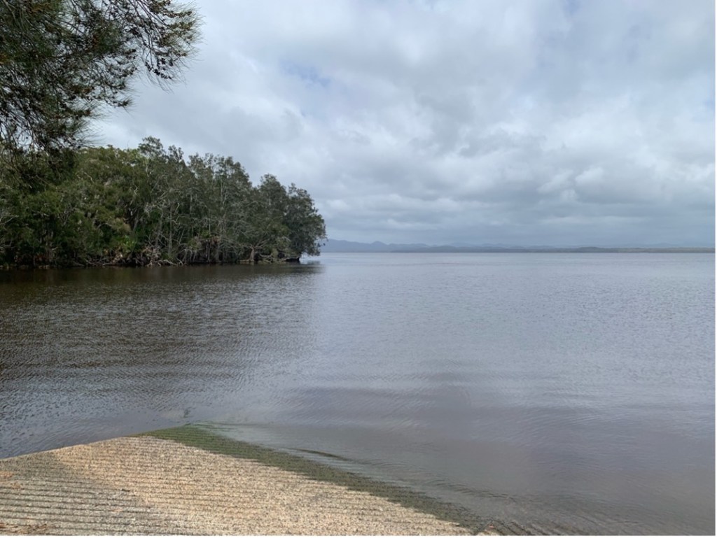
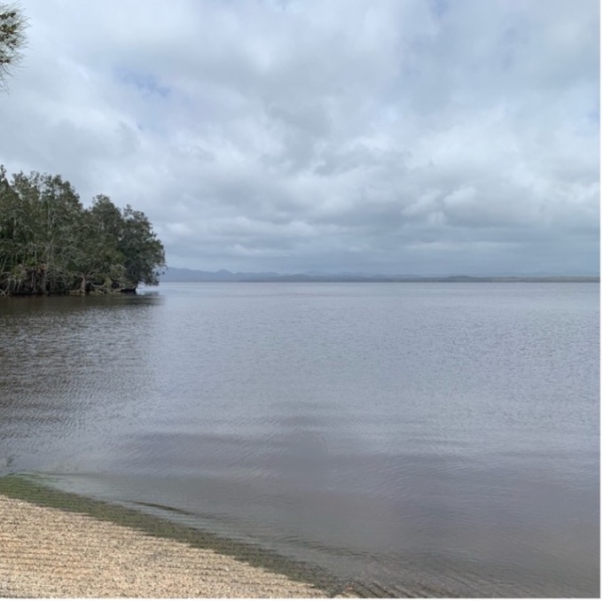
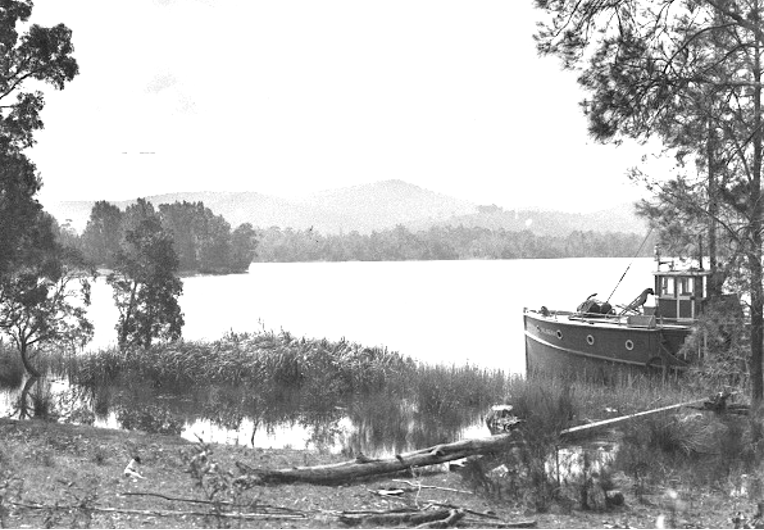
The Broadwater – Myall Lakes [Author photo – March 2024]
We were now about 20 miles from Port Stephens, as far as I could judge, and had not met a single vessel or even a human being of any description on our passage. The mammalia were represented by an occasional cow and horse, and once by a team of liberated working bullocks, the property of some neighbouring sawyer; but, these were the only indicia of civilisation we saw. Not a cottage or a hut broke the wild and therefor captivating monotony of the riverbank. No larikin seemed ever to have visited those sequestered reaches; no broken bottles or bits of newspaper hinted the visitations of Cockneys……
Dinner over, we passed through the channel formed by stone dyke into the lake, rousing up in our passage some hundreds of back swans enjoying their noonday siesta, perched on the stones about the edges of the lake, and with heads concealed under the left wing, as if thereby to make up for the want of head-coverings when the sun was high in heaven and drowsiness ruled supreme over the animal world. Here we became aware that a splendid north-easter was ruffling the surface of the lake as far as the eye could reach.
Our course lay north-west for the Buladelah River, which debouched into the Broadwater, about six miles away, under a range of hills covered with splendid timber. Bushfires were visible in three or four directions, and one within a mile of us was obscuring the sky with volumes of lurid smoke. Why was that brisk north-east wind so blithe and exhilarating as it wafted us past one headland and another toward the reedy mouth of the Bulahdelah River? …..
With frequent apologies to the swans for disturbing them by the unwanted intrusion of tan sails on the peaceful bosom of their own beauteous domain, we sped on to its north-west corner, and there, for the first time, tried the quality of two chokebores on an assemblage of coots which must have numbered not less than a thousand. They were long shots, but we picked up seven, and felt some satisfaction in the prospect of supper, for a coot, though not quite as good as a black duck or a teal, is very good food, especially when stewed; and what is equally important, he is not a “scheduled bird” under that inexorable Game Act of ours, like his privileged countrymen, the black duck and the laughing jackass.
Picking up our birds—that is to say, our supper— we dowsed sail, set the awning, and again started the persuasive scull-oars in half-hour spells. The Bulahdelah River, or, as some persons prefer to call it, the continuation of the Myall, spreads out about a mile from its entrance to the Broadwater into a little labyrinth, which, of course, attracts you by its wider channel. We got into the labyrinth, and found it a blind lagoon, choked with bulrushes and haunted by bevies of wild fowl which knew perfectly well dial their close season was not yet over. After starling hundreds of them from their lairs we harked back and got on the main stream. Here there is no tide, and the only alteration of water-level is caused by floods. Away we sped up the river at the rate of six miles an hour at least, and after about an hour’s pull we found the water almost fresh, the banks covered with overhanging ti-tree and a profusion of lilies, but still flat and bearing evidences of recent inundation.
Presently there was a change in the character of the vegetation. Enormous grey gums and flooded gums lifted their crest 200 feet above the strangled underwood, and innumerable parrots and leather-heads made a continual concert high up among the branches. All sorts and sizes of staghorn ferns and other parasitic plants hung in the forks of the swamp oaks, and wildernesses of clematis drooped in festoons towards the ground. Huge cabbage tree palms and ferns spread out their pride of brilliant foliage and afforded a grateful shade, while on the surface of the river, still deep and wide and smooth, their varied outlines mingled, with the stately gum trees and the sombre foliage of swamp oaks in a sort of inverted water photograph, so perfectly defined that it took one some time to determine which was the more delightful, the picture in the water or the reality on the banks.
The small white-bellied shags were evidently much at home on these reaches. Every hundred yards or so a family of them would crane out their inquiring necks, as the skiff approached some overhanging dead tree which served them for a perch, and deprecating closer acquaintance scud away up the river, transmitting their suspicions on the way to an occasional blue crane moping on a log, or to their cousins the big black shags, intent as usual on diving for their interminable fish dinners. A few large fan-tailed divers were met with, but they seemed to pay no heed to us, beyond the ordinary courtesy of projecting their slim necks towards us, much after the fashion of a snake. …..
After measuring six or seven miles from the Broadwater we entered a magnificent reach, margined with luxuriant trees on the banks, and fringed with sedges and lilies to the very edge of the water. It must have been fully two miles long and straight as an arrow. Here we put on a grand spurt, aid when we reached the far end shoved the skiff’s nose into the bulrushes and camped for dinner under the shadow of some dark green cork trees. An hour’s spell and a hearty meal of corned beef, damper, and tea brought us all pleasantly to our bearings, and as the sun was getting low we lost no time in siestas or lotus-eating, but resumed the labouring oar once more, and continued our upward voyage.
The only living things (not birds) which we met until we got to a mill known as Dixon’s, about four miles below the village of Bulahdelah, were one sawyer, a few nomadic and solemn working bullocks, and some skittishly inclined steers and heifers, which as we passed along the bank, where they were busy discussing some water plant or other, would stare at us for a moment, and the next, with “flags” erect and horror in their faces, rush madly for cover into the neighbouring thickets, where the tinkling bell betrayed the presence of some steady and paternal old “worker” enjoying his well-earned repose from log-handling.
At 7 o’clock we reached Bulahdelah, after passing a few evidences of settlement in the shape of decayed, fences and old cultivation paddocks, and, about two miles below the township, an old farmhouse prettily situated under a high range of hills, but with a desolate look about it, as if its owner and prosperity had not been bedfellows for a very long time. Bulahdelah boasts of a police magistrate and a constable, and such other apparatus of civilisation as a store or two, a public-house, a lockup, church (or a building which looked as if it were meant to do duty for one), a punt, and about a couple of dozen of scattered shanties and tumbledown cottages.
Waterfront at Bulahdelah, 1924 [Sydney Mail, 20 August 1924]
It is s perched on a declivity of a steep range on the east bank of the river, and is, taking it all in all, about the most dismal, God-forsaken place I ever saw in New South Wales. We left the boat tied up to a tree near the punt-landing and landed to explore the village, in quest of supplies. We could get neither beef nor mutton nor bacon, nor tinned provisions of any kind more nourishing than jam. It is clearly no use taking money to Bulahdelah; you could not spend a sovereign in a month there except, perhaps, in gambling.
The river yields fresh water enough, but they told me the inhabitants preferred to get their supplies elsewhere, as a prejudice prevails against the water of the river. We, however, used it without any evil results. Having decided that the attractions of Bulahdelah are confined to the 20 miles of glorious river scenery which the traveller passes to get to it, we agreed to embark again on the skiff, pull down the stream (if there is any “down” in so perfectly level a waterway), and make our camp for the night near the desolate farmhouse. We made a very fair camp with the awning and the sails, and, after a refreshing night’s rest, following a somewhat frugal repast and preceding an equally frugal breakfast, we bade good-bye to Bulahdelah, and hoisted our blue peter [blue flag] for the Broadwater.’
Upper Myall Lakes
The Sydney Mail and New South Wales Advertiser of 25 October 1884, page 850, reported:
On Sunday morning ….. we commenced our return voyage [to Sydney]; two of us paddling leisurely along, while the same number walked the banks in quest of wongas. …..
So, after a walk of half-a-dozen miles, through the dewy underwood, with an occasional chance of clear ground when the cattle track went in the right direction, we struck the river and waited for the skiff without a solitary wonga in our bags. We might have caused any number of parrots, mockers, and leatherheads to give up the ghost, but hunger had not yet with us reached the parrot stage. Rejoining the skiff, we spread the awning and pulled away merrily enough for about eight miles. Then we camped and had some damper, quart pot tea, and jam, by way of tiffin.
Resuming our oars, we passed through that magnificent reach of the river described in my last chapter, and descried at the end of it, perched on a skeleton grey gum near the edge, a splendid brown eagle. Will jumped up and crammed a cartridge in the Henry, and we rowed gently to a position about 150 yards from the Jovian bird, who seemed perfectly certain that we could do him no harm from that distance. But the fatal tube in my chief officer’s steady hands was destined to carry his death-warrant. “Ping,” as before, with the pelicans, and down dropped the eagle— a magnificent fellow, with talons capable of carrying off a good-sized wallaby— at the foot of the tree, with a bullet through his neck, close under the head. …..
Reaching the Broadwater about 2 o’clock, we found a stiff north-easter blowing, and that meant a good long beat to Bumble Point, or Blackfellows’ Crossing, as some people call it, which separates the Broadwater from the Upper Myall Lakes. We got to Bumble Point about 4 o’clock, after a very pleasant two hours’ welting to windward, during which, I suppose, we must have roused up two or three dozen assemblages of swans and ducks. But they would none of them let our tanned sail get within 200 yards of their nobility.
A view of Myall Lakes
If the Broadwater is in shape like an inflated wine or water skin, such as they use in Spain and other parts of Europe, Bumble Point or the Crossing would be the neck of it. The lake is only a short mile or so from the ocean and the intervening neck of land is almost a dead flat, covered with swamp ti-tree and swamp oak. The only high land is on the Bulahdelah or western side, but there the timber is very fine and keeps a sawmill in constant work in a corner known as Dirty Creek, euphony being no more studied in this part of the colony than in any otter rural districts.
The lake averages a depth of perhaps eight or ten feet, though there are many shallow patches (one very large one, almost in the centre), which do not carry more than three feet. Owing to this condition a strong breeze from W. or N.E. or S. soon raises a very troublesome sort of sea on the lee shores quite unlike the regular and long roll which a similar breeze brings up in deep waters like Sydney Harbour. The lake sea is short, and with a tendency to break on board, and a boat does not seem so lively in it as in salter and deeper water. But there are no snags, and no rocks, except close ashore, so that the only danger is the shallow patch in the middle, and it is easily seen and avoided, or if your boat does not draw over two feet you can run over it.
Passing from Broadwater through the Narrows into the small reedy lake, or series of lakes, higher up (the Narrows at Bumble Point are not more than 70 yards wide), we were still obliged to fight the north-easter; but there was plenty of water to tack in, almost up to the reeds, which in many places advance into the lake at least 150 yards, and provide shelter for enormous flocks of coots, and no doubt in the season for many families of black ducks and teal. We saw in a distance of a couple of miles many thousands of coots. Sometimes a flock would cover a space 100 yards square, and when it rose as the boat approached near gunshot, the patter of many thousand wings, as the birds beat the water with them, and their half-webbed feet in the process of passing from paddling to flight, was like the sound of distant vollies.
At the head of “Reedy Lake,” as we christened this sheet of water for want of a more descriptive name, and in ignorance of its proper one, are the ruins of a large sawmill, which when I was last in these waters was the centre of a thriving colony of Scotch sawyers, employed by a tall red-haired Highlander named McCrae or McCraw, I forget which, but as fine a specimen of a white man as one could desire. But there was no Highlander here during this visit of ours, and everything had a dismal look of desertion about it. The machinery was gone, and everything that could be removed. The chimney alone remained to show where the “circulars” and the “verticals” used once to provide sawn stuff in unlimited thousands of feet, as witness the mountain of sawdust and stripping’s projecting into the lake from the spot where the mill was fed with logs in bygone years; a curious memorial of the splendid forest which once clothed these hills, but has left no second growth behind it as yet fit for the saw, if ever it will be. Two or three rotting punts, the bottoms riddled with carbro, lay in the ooze near the sawdust, but the only animation visible was on the water.
As far as the eye could reach flock after flock of coots, teal, and black swans, were swimming along the margin of the reeds, but they all seemed to know by a sort of instinct that 100 yards were quite little enough to separate us from them. Passing by the old mill, our course lay nearly east, and after a beat still to windward of an hour, we passed the two picturesque little wooded islets which lie in the opening to the Upper Myall Lake, the largest of the entire series.
At this point we found signs of permanent habitation; one was a cottage and some cleared ground on the north side of the narrows, and the other on the south side, a farmhouse on a projecting tongue of land, on which all the timber had been ringbarked. A herd of dairy cattle was browsing on this ridge, which appeared to be well grassed for the time of the year and the long drought which had been prevailing. This place was a virgin forest, when I had visited the Myall Lakes. It is now a thriving homestead selection belonging to Mr. Charles Bonney, a good-natured Yankee, who, with his sons, makes an excellent business by drawing timber for the various mills farther up the lake.
Charles Bonney is an enterprising fellow, as he ought to be, coming from the State of Maine, and had been in the colony for many years, during some of which he had been with McCrae, who, he told me, was now living up Bullambeet Creek, “close handy.” I had a mind and a half to go and look him up, for I owe him a debt of grateful memories to many good services. Bonney had a selection of 640 acres, so situated that he had entire command of about 20 miles of country, but grass is not plentiful, and what there is won’t fatten stock well for the market. He told me that the emus often came sailing down the ridge, almost to the door of his cottage, and creating stampedes among the cattle. “Werook,” which is the name of Bonney’s homestead, is charmingly situated, and in ordinary weather must be very productive. When we were there, the drought had ruined nearly everything— pumpkins, maize, watermelons, cucumbers, everything seemed to be in extremis!
We passed on and entered the big lake, where we found the southern shores covered to a depth of a foot or more with snow-white flakes of foam as far as the eve could reach. This was the work of the north-easter blowing during a succession of days; but there must be something in the condition of the water (which is brackish) to account for the peculiar facility with which, after a little chafing, it deposits these continuous wreaths of whipped cream. I have seen the same deposits of foam on the margins of some of the fresh-water lakes in the interior, but never such a supply of it as here. In one corner we saw an island of it piled up to the full height of the reeds, and the effect was as if all the soapsuds in the world had been collected in one spot to bewilder us.
The Upper Myall, or Big Lake, is of rather irregular shape. Its extreme length might be about 9 or 10 miles, by a width varying from 1½ to three or four miles. The country is bold on every side, and especially to the west and north-west, where the hills reach the altitude of respectable mountains, that is to say, 800 to 1000 feet. There are three well-wooded islands in the lake, the largest containing about 100 acres. They are all covered with a reedy grass, which renders walking rather troublesome, while the surface is not improved by all sorts and sizes of rough boulders very treacherous to boots with nails in the heels.
The scenery of the Big Lake is of itself quite worth the journey from Port Stephens. There must be plenty of mullet in the bays and creeks, for we were rarely a minute without seeing some huge fellow toss himself into the air. This saltatory habit of the lake mullet (which is precisely the same fish we know as the sea mullet) must surely be the result of a natural instinct for diversion. The fish does not feed on insects, but on mud, and it does not jump to escape from the pursuit of an enemy, for in these brackish lakes of the Myall, it has no enemies but the fisherman and the fish-hawks. In former times this splendid fish was, of course, the staff of life for all the fishing tribes of aboriginals living about the lakes; and the business of spearing and netting him was, doubtless, the principal work of the day; but all that is changed now; almost all the aboriginals in the district are quartered about Port Stephens, and they only visit the lake country occasionally, for the Government, or rather the Aboriginals Protectorate, have given them a fine fishing boat and gear, and with this they manage to make a better living in Port Stephens than they could on the lakes.
A blackfellow once told me that mullet jumped up out of the water in order to see which direction they ought to follow to get to their destination; just as a porpoise comes to the surface to discharge air and take in a fresh supply; but I am rather incredulous about that, for all our other high-swimming fish manage to get along without jumping out of the water to find out the right direction. After a splendid cruise all over the lake as far as Croll’s mill, we determined, much against the grain, to return to Bonney’s for the night.
We were in sad straits for meat and knew that he could let us have a junk or two of salt beef at all events. So just about duck helm up! and away we ran with boom well out and squaresail set (every stitch we could carry) before a rattling breeze. It was near 9 o’clock before we had picked a place for our camp close by “Werook,” under the lee of come swamp oaks. Here we negotiated the coots, and an admirable supper they yielded us, with two redbills and a brace of whistling ducks, which we shot on our way up. The chief cook stewed them with a few onions, some rice and biscuit, in a large billy; but it was impossible for the boys, who were ravenous for their supper, to wait for three hours. They determined to fossick about and see what supplies the neighbours might be induced to part with, and in the course of an hour they returned with damper and eggs, and a large jug of new milk. This took the edge off their veracity, and they were able to survey my operations with less impatience. ….
Shortly after daylight on the last day of the year, which found us in this remote part of the world, while some of us struck camp and packed everything away in the skiff, others paid a visit to Mr. and Mrs. Bonney in their charming country residence of “Werook.” They received us with that most perfect of all courtesies, simply hospitality and after a long yarn with Mr. Bonney about old histories, we left him with two junks of salt beef in our haversack, and a splendid supply of milk and home-made bread and fresh butter in our basket. Alas! I offended our worthy benefactor by proffering payment but finding that he was one of the old school, promptly apologised for my indiscretion, and we left “Werook” with many mutual good wishes, and promises, all of which, I hope, may be fulfilled in the fulness of time. He told us that a sailing boat had passed up the lake the day before with a curious cargo— at least, so he seemed to regard it— namely, two “lawyers” from Sydney. He said that sawyers were familiar objects, but as to lawyers, it puzzled him what they could be after in that peaceful part of the world. When he told me their names, I comforted him by an assurance that they were certainly up to no mischief, but were probably “excurting” for fresh air and fresh scenery like ourselves……
At 6 o’clock in the afternoon we reached Bumble with five coots and several redbills in the boot; and we ought to have had a couple of black ducks, but the chief officer’s fowling-piece (sad contrast to his rifle) could not be persuaded to go off at the right time. There was just enough daylight to cut poles for the camp and to get everything ready for a good long night’s rest on the little patch of grass at the extremity of the point, which for more abundant luxury we strewed with delicious fresh rushes. …..
So we spent New Year’s Eve at Bumble Point under canvas, ….. Bumble Point is, perhaps, better known as the black-fellows’ crossing-place, for here the ancient possessors of the soil found the most convenient passage from one side of the lake to the other in water not more than four feet deep. No canoes were needed. It was, and is, an easy ford; and, moreover, the place was admirably suited for meshing and spearing fish, which abound at this point, especially the large perch, which, when in prime condition, is even a better fish than the yellow-finned sea bream caught at the mouth of the Hawkesbury, and notably at Dangar Island. No wonder, therefore, that Bumble Point was in old times a great resort of the ancient “Thoroughbreds.”
On New Year’s Day we made an early start; it always took nearly two hours to pack away the camp, and the various utensils appertaining thereto …. About 8 o’clock we got honestly under weigh, and the north-easter got under weigh too. After rolling off a mile or so on our road to Tamboys, across our old friend, the Broadwater, we ran almost into a mob of black swans, which contained several “quillers;” that is to say, birds which had moulted their pinion feathers and were only able to flutter along the surface of the water for a few hundred yards. I determined to capture some of them and take them to Sydney as a present to the “Zoo.” These “quillers’ (as they are called) sometime hide themselves in the big flocks, and sometimes keep to themselves. The general moulting time is about Easter, but during the summer months there are always some swans moulting where there are large gatherings of them. …..
We passed Tamboys (where the Myall enters the Broadwater) while the day was still young, but as the sun rose higher in the heavens the sail was stowed and the awning spread. We rowed on (all but our sick man) in easy spells and camped for dinner a few miles above the Tea Gardens. After a modest repast, we continued our course down the river, starting several flocks of black ducks above the Mangrove Islands; and, having reached the Tea Gardens about 5 o’clock, went ashore and made some purchases at the store, among them being a box of Cookle’s Anti Bilious pills.

Advertisement for Cockle’s Ant-Bilious Pills
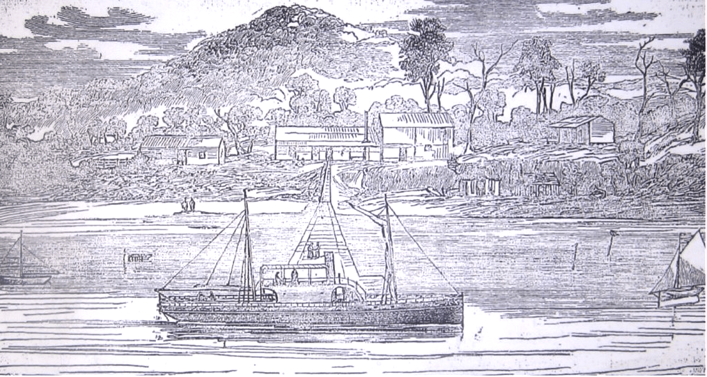
There were several ketches alongside the riverbank, ready to load timber as soon as the holidays were over; and with them was a steamer, which traded to Newcastle, the Myall. This vessel offers an excellent opportunity to persons desirous of visiting these lakes, as she is a regular trader, and could carry half-a-dozen skiffs on board comfortably. All that is necessary to take care of is so to time your arrival at Newcastle to catch her. Again embarking, we dropped down the Myall past Windy Wapper [Winda Woppa] to Myall Point, and there we found a strong floodtide setting in.
It was a hard pull to get to Nelson Bay after the fatigues of the day, but we reached our old quarters shortly after nightfall, and Mr. Dalgleish kindly brough us letters from home reporting all well. After giving Will a couple of Mr. Cockle’s panaceas, we indulged in a light supper, and soon after all turned in, thoroughly well tired, but delighted above measure with our trip and sorry that it was over. The yacht was found just as we left her, and our only grief was that a lobster which we had left below the ballast deck for bait before leaving, having become fearfully ancient and fish-like, gave us the trouble of washing down and airing our apartments before we could venture to occupy them for the night.’
Reconnoitring Around Port Stephens and Broughton Island
The Sydney Mail and New South Wales Advertiser, 8 November 1884, page 953, reported:
‘Breakfast over, we had a great overhauling inspection of the Bandicoot, shook out the sails and aired them, cleared everything for action, and landed all the square sail gear, sweeps, and other impedimenta on the jetty. Then, embarking Hollis and some of his relatives, and a great dish of damper fresh from the camp oven, the workmanship of his hospitable wife, we dropped out of Nelson Bay for a general exploration of the port on picnic principles. We spent three days altogether of the new year cruising about the glorious harbour, sometimes in the yacht, and at other times in the skiff. But as my story is meant to tempt yachtsmen rather than boating men pay a visit to Port Stephens, I will give the reader a seat on board the Bandicoot this time, and he shall judge for himself what sort of a place it is.
With our light draught we could lie snugly tied up to the jetty, but anything drawing more than five feet would have to moor a cable’s length or so further out; but even there the strength of the stream would not be encountered. Between Nelson Bay, and the sandbanks and shoal-ground, which extend like a huge crescent from Myall Point to near Yacaaba, the fairway available for working in under canvas is about half a mile in width, in some places more, in others rather less. The ebb in this rather narrow water is very strong, sometimes more than three knots; the flood is not so strong, but as the winds in the yachting season blow either from N.E. or S., there is plenty of room for a good big vessel to work in.
There was a brisk southerly blowing when we got under weigh, and it increased as we got out of the shelter of the land. Corlette Head, about three miles from our anchorage, was the first prominent headland passed. It forms the eastern point of Salamander Bay, so called after her Majesty’s old “paddle-flapper” of that name, which they told me used to prefer this bay as an anchorage during her surveying visits to this part of the coast. Salamander Bay is a splendid cove, a beautiful white strand thickly wooded to water’s edge, and extending in shape like a boomerang for a about two and a half miles, as far as the conspicuous headland called Soldiers Point, as a memorial of the redcoats who, in by-gone years, there formed a sort of permanent encampment within a stockage to prevent runaway convicts from the settlement further up, and from Port Macquarie, swimming across to Bundabah Island, and thence to the Point.
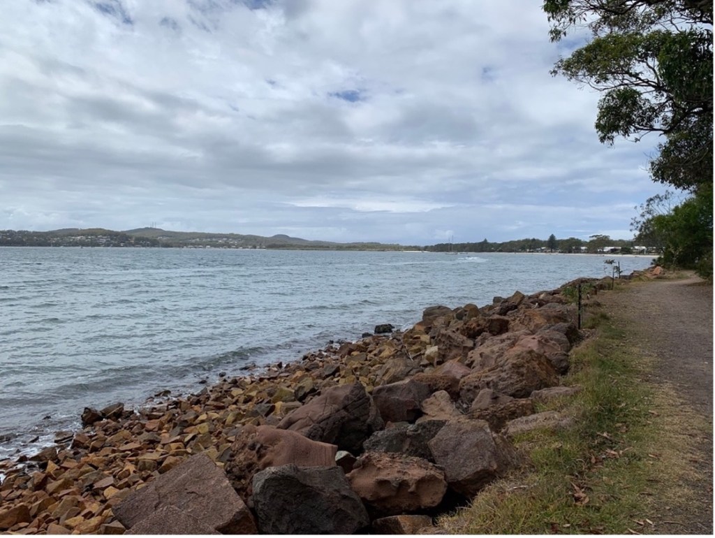
Salamander Bay [author photo -January 2023]
As we passed this magnificent bay the beach was lined with black swans, distinctly visible to the naked eye, and very plainly by the field-glasses. But at a distance of more than three-quarters of a mile they were safe. The channel we passed down, or rather up, is called the South Channel, to distinguish it from the Middle Channel, which is used by the coasters, but is not recommended for yachts. The anchorage in Salamander is excellent. You can have five fathoms a cable length from the beach, and 8, 9, and 13 fathoms a little further out, and good water is to be bad in any quantity just in the bight round Corlette Head.
Between Nelson Bay and Corlette Head there is no danger, except a small patch of rocks known as the “Red Patch,” lying a few hundred yards off a red headland, but a berth of a quarter of a mile or even less from the shore clears this patch easily. The course from Corlette Head to Soldiers’ Point is to steer, if there is a leading wind, direct for the island lying almost midway in the charnel. This will take you clear of West Bank to the northward, and of “Soldier Spit,” just off the point where the chart marks only three-quarters of a fathom. Then as you approach the island— it is called “Bundabah” — haul up and pass as nearly as possible in mid-channel between the island and the point.
The deepest water in Port Stephens is just a cable’s length south of Bundabah— 24 fathoms, and some of the shallowest lies hereabout also, for to the W.N.W. of, and about a quarter of a mile from, this same island Fly Rock comes to the surface, a rather nasty danger, for it is almost within the track of a vessel working up to the anchorage off Baromee Point. As we approached Bundabah, and the Soldiers’ Point ridge no longer intercepted the view westward, the whole expanse of the inner harbour burst on our view. Away to the westward we could discern the relics of Carrington, a few old cottages, almost hull down and distant about four miles; and between it and the “Narrow” some finely-wooded hills, broken by the two coves known as Balberook and North Arm.
The bold promontory directly north of us, and eastward of the small creek called Nanabah, or Fame Cove, descends to the water in an abrupt front, forming the northern retaining wall of these “Narrows,” which give us rather less than a good half-mile to work in, for to the W. we see several patches of rocks awash, with Bush islet to the S. of them and still further S. two low but larger, islets; one covered with grass and oysters, and the other, the larger one, fringed with a heavy growth of mangrove encircling a morass of swamp oaks. This last is Dowadee, or Mosquito Island. Let us call it Mosquito Island preferably, for cogent reasons appearing hereafter.
Behind Carrington, or what remains of that ancient settlement of the great A. A. Company, the land rises to the height of about 600 feet, and is very picturesque. Westward of Carrington it seems to descend into a jutting, densely wooded promontory, where we can easily (with the glass) detect a large house with a flagstaff on which flaunts large red ensign. That is Tahlee, where lives the king of Port Stephens when Parliament does not demand his presence in Sydney. He is the member for this district, and all that Myall Lake away up to Cape Hawke, and I don’t know how far back, is his electorate. Here at Tahlee his Majesty during the recess dispenses a right royal hospitality to white fellows and blackfellows indiscriminately, and as in duty bound, here I did obeisance as one of the pale-faced class of his subjects.

Drawing of the original Tahlee House – 8 February 1840 [State Library NSW]
He has ever so many boats, an excellent landing-place, is a famous shot with a rifle, an ardent fisherman and sportsman, and is a general favourite. Here also lives his aged father, who is said to be even a better shot than his son, and whose knowledge of the antiquities of Port Stephens and the district is said to surpass that of any living being. I did not have the privilege of a presentation to the old gentleman during this visit, which I greatly lamented for many reasons.
Leaving Tahlee, the eye ranges over immense spaces of water, with vistas of mangrove islands stretching away up to Karuah River, towards Sawyer’s Point, where the channel closes in a little, and the banks become steeper and better defined. There is a bifurcation of the Karuah about two miles from Tahlee, and a swampy mangrove-covered flat, known as Wirrrung, divides the stream into two courses— the coaster’s channel to the south, and a shallow boat channel to the north. The distant reaches of Swan Bay, with low shores fringed with mangrove, and Carcair Point; putting out as a beacon for the two-fathom channel, and the long low mangrove shore sweeping away from that point to form another still larger bay (the name of which I forget), offer an horizon of water bounded only by land as the eye glasses to the south-west and recognizes first Tanilba Point, then Mallabula, and last of all the entrance to Telligherry [Tilligerry] Creek.
We are looking over altogether about 30 square miles of quiet water; and except the islands and islets already mentioned, there is none which stands out to vary the waterscape but Snapper Island, or, as it is sometimes called, Cabbage Tree, though the real Cabbage Tree lies outside the heads of Port Stephens, a short mile N.E. of Yacaaba. Snapper Island was our destination after we had coasted along past Fame Point towards Baromee, where is the anchorage (or at least half a mile westward from the last-named point) for vessels drawing mud-water. These are unable to approach nearer Carrington or Tahlee than about a mile to the eastward of the little island called Goat Island, lying about half a mile S.E. of Carrington.
If the Wolverene takes the Parliamentary picnic to Port Stephens, as rumour says is to be done, Captain Taylor will have to drop, his mudhook about half-a-mile off Baronice, and a little less than two miles from Carrington, for beyond that position the water shoals rapidly to 2½ and 1¼ fathoms [The Wolverene cruise did not eventuate]. From Baromee anchorage we had to make a short board to reach Snapper Island, under the lee of which we cast anchor about noon in about 10 feet of water, rough furled the mainsail, handed the jib, and furled the foresail on its stay, the last a much better plan than lowering it on the deck when you are not going to remain long at anchor and are likely to bring plenty of mud back with you, a certainty in this part of Port Stephens.
Ashore to the island, which at low water will give you such a feast of foreshore oysters, or bankers, as you never before partook of. The boys were in great form for the “delicious bivalve,” and so were our guests from the bay. There was a damper as big as a small cartwheel (a very small one of course), plenty of fresh butter, and pale ale was not absent. The result may be guessed. When we had finished the last bushel of Snapper Island oysters, and had roamed all over the beautiful little spot (it is a tropical jungle of cabbagetree palms, vines, fig trees, and other umbrageous and giant forms), where we would have stayed, like the lotus-eaters, for ever but for the mosquitoes, very reluctantly we embarked in the skiff and got aboard the yacht, carrying with us, for fear of supervening hunger, two bags of the lamelli-branchiate, molluscous dainties, which, to our horror, we afterwards found had been not long before tabooed by their worships the Commissioners of Fisheries. …..
We made a couple of short boards from under the lee of Snapper Island, and were soon abreast of Tanilba, about a mile and a quarter, or perhaps less, to the southward. Leaving a couple of hands on board to hang off and on for an hour. I took the skiff and went ashore to see what remained of old Tanilba House, once as pleasant a retreat as ever mortal man could wish to pass the afternoon of a busy life in. I first visited the place in ’52, and then it was in a rather ruinous condition. I think it was originally the home of the Caswell family, but now it is deplorable to walk about the ruins. You can trace the positions of the orchard, the vineyard, and the parterres, and even still the lemon trees and olives keep up a brave fight with the indigenous swamp oaks and other native vegetation striving to obliterate all traces of the work of man by the original wilderness—and alas! by the original, autochthonous mosquito.
We wandered about for nearly an hour, until either the mosquitoes or the melancholy of the scene became too much for us. If ever a place were the haunted look, and seemed well qualified to have been the subject of Tom Hood’s famous verses, it is Tanilba House. The sun had sloped well towards the hills behind Swan Bay when the Bandicoot was got under weigh for a cruise along the southern shore from Tanilba to Telligherry Creek and Cromarty farm further on. There were no dangers, and with the wind well abeam and plenty of it we were not long covering the interval of five miles.
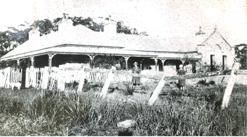
Tanilba House – circa 1920
We cast anchor again, this time well to windward of the patch known as “Botaynbah” rocks, and a short cable’s length from the rocky point to the southward of the little bay below the old farm. Landing in the skiff, we hurried up to the old orchard, but alas! there was nothing but desolation and mosquitoes. The orange trees (once luxuriant bearers), plum, peach, apple, loquat, and all other fruit trees were in ruins like the old farmhouse. The vertebral bones of whales were lying scattered all about the place— Port Stephens was in old times a great resort for whalers— but except a few crabby apples not worth gathering and some green oranges, which it would have been a sin to pluck, fruit there was none.
Like all other farmhouses and residences about Port Stephens, Cromarty farm has a history of its own, and some day, perhaps, I may give it to the editor; but we are yachting now, not picking up antiquities. Embarking again after a very short run ashore, we weighed and ran away before the breeze, still as good as ever until we were enough to windward of the Mosquito Island to be able to drop anchor and pay it a visit in quest of wild ducks, always fond of making the swamp in the middle of this gruesome place a sort of rendezvous.
Landing on the island anywhere except on a little sandy beach at the north-east corner is a business. The shores are covered with oyster shells, stratified in all stages of life and death, congregated so thickly as oysters ever were on boulders both hard and sharp. Then comes mud and a dense fringe of mangrove, then swamp oak and ti-tree; and enthroned above and overall and everywhere is the bloodthirsty miscreant which gives a name to the island. I have now and then faced some queer customers with prongs on their heads in stockyards at mustering or branding time; but, honestly speaking, I believe it would cost me a smaller pang to jump into such a place again than to go ashore in January on that dreadful island.
We did not shoot any ducks, for nobody had time to do anything except flap the little brutes out of his eyes, nostrils, and ears, and smash them on his cheeks, forehead, and hands. Twenty minutes of this sort of thing was too much joy, more than we desired or deserved, so we turned on our pivots and got aboard as fast as possible, and during the rest of the homeward voyage everybody’s engrossing entertainment was mosquito-smashing.
We got home just before dusk, and after as accurate a calculation as we could indulge in it was generally agreed that we had turned about 27,000,000 mosquitos into jam. And even then we were not able to comfort ourselves with the assurance that they had all been disposed of, for days after we found them lurking in the yacht’s lockers and under the carlines and wherever else they could stow away their venomous and most accursed little carcasses. …..
As we passed through the deep but rather narrow channel separating Bundabah from Soldiers’ Point (I wonder what the soldiers did to endure the Mosquito Island savages in old days) the floodtide met us like a millrace, but the wind was good enough, and we stemmed the stream, but somewhat laboriously. The pangs of hunger seemed to seize all hands just when we had passed Soldiers’ Spit and opened Salamander Bay, and we appeased them during the reach home with a varied assortment of tinned “make believe,” such as salmon, corned beef, tongues, and even jam. …..
At last, we got alongside the jetty at Nelson Bay, and made all snug for the night, which threatened a storm, but nothing serious came of it. The next two days we passed yachting or skiffing, but principally the latter, for the skiff was handier in shallow water than the yacht. During those days we must have covered a considerable length of water, but beyond that the log is silent. We tried several famous old schnapper grounds outside, but with indifferent luck. The fish seemed to have taken off in a remarkable manner, but we got any quantity of splendid bream and whiting from the fishermen, and whenever we cared to “burley” the black bream at our moorings we could always manage to catch a couple of dozen of them, especially about sundown.
A person visiting Port Stephens for the first time will find no lack of pleasant strolling grounds about Nelson Bay; two among them being the track from the Nelson Head telegraph and signal station to the lighthouse on Point Stephens, across the strip of sand (which is sometimes submerged) called Narrow Gut, and the track round the southern shore along Salamander Bay, and across the ridge to Cromarty Farm. If he likes climbing Tomaree and Yacaaba will afford him plenty of scope for a bit of mountaineering, and from either of their summits he will be repaid for the toil of ascending by a glorious view. During all this interval spent in smooth water but very pleasant exploration of Port Stephens, our captives, the four black swans, were quartered in a fowl house kindly lent by Mr. Dalgleish, the post and telegraph master, and once they were treated to a swim in the bay, which was evidently a very great treat to the poor birds. It was one we often indulged them with afterwards when bar-bound at Lake Macquarie.
The chief officer, after the spell of comparative repose and more regular living, had by this time (5th January) quite regained his customary spirits, and he and the rest of the crew were eager to be up and doing. So bidding good-bye to friend Hollis and the rest of the good folk at Nelson Bay, whose kindness to us will not soon be forgotten, we got under weigh one Saturday morning for the Broughton Islands, with the skiff astern, several days’ provisions on board, including some choice specimens of Mr. Hollis’s art in damper-bread, and with water tanks full up. The swans were carefully housed astern in the lazzareet, or steering well, and were apparently quite reconciled to altered circumstances, and unlimited soaked biscuit. …..
As we passed Nelson Head Station we dipped our ensign to Mr. Glover as a last valedictory courtesy, and with the end of the flood tide managed to drift out against a very light air from eastward. Yacaaba, under the early morning light, had decked himself in all the dark lustrous tints of his regalia, and as the mowing, lazy surges smote his seaward buttresses, and shot upward in sheets of sparkling brine, there was waited towards us just that pungent and exhilarating odour of the mighty ocean which is life to so few, and death to so many of us. …..
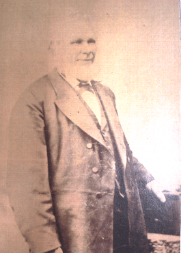
William Glover – first keeper of the Nelson Head Inner Light
After an hour’s tranquil obedience to the young ebb we got as far as Cabbage Tree Island, about a mile north-east of Yacaaba, and then found the young north-easter— a “dead muzzler” for us, whose destination was Esmeralda Cove, at Long Island (Broughton Island). It was past dinnertime when we hit Cabbage Tree astern, but not past the time for eating it. The skiff was put on a long bridle, so that she might tow more easily. Our plan was to lash a block to the ringbolt in her nose and pass a 2½-inch coir warp through it, bringing both ends aboard the yacht’s quarters, so as to let her ride at the safe distance of about 40 yards. This distance is of course only necessary when there is a big sea and you are running, but close hauled; you can shorten up the bridle to about 40 feet, or even less. …..
After 3 o’clock the north-easter came down with unexpected savage gusts, and the beat to windward, though it was only some nine or 10 miles, began to be interesting. However, it did not behove us to do any reefing, though the skiff astern plunged and kicked like a wild colt at his first handling. Shortly before dusk we were lying snug in Esmeralda Cove, perhaps one of the most extraordinary of miniature harbours of refuge in the world. I was first introduced to Esmeralda Cove, then known as the boat harbour of Long Island, many years ago, as a passenger to Sydney by a Manning River schooner of the old type. Since that time I had been three times in the place, and each time was more astonished by the marvellously safe refuge it offers from easterly or south-easterly gales. Nobody can mistake the cove. South rock, a bold sugar-loaf shaped eminence, projects about the centre of the largest of the islands (Long Island) in a direction as nearly as possible S.S.E., and in the western beacon, while a bold headland of less elevation than South Rock, which is about 160 feet high) marks the eastern or seaward front.

Esmeralda Cove – Broughton Island
The entrance is less than two cables’ length in width, and the whole length of the cove scooped out between these two promontories might be about 600 yards. There is a big sunken rock, or “bumborer,” lying a short distance inside South Rock, but not so much abreast of the entrance as to be dangerous. As a rule, the sea breaks on this bumborer, but there is plenty of room for a yacht to work up to an anchorage at the head of the cove. About a quarter of a mile from the entrance the cove forks out into two recesses, of which the eastern is the right one.
At the extremity you run into absolutely calm water, and in the very worst weather (i.e., an easterly gale) you can ride on a bridle head to S.S.E. in about four fathoms, and smile at the elements, and the drawback will be less than it would be on similar occasions at boat harbours on the coast. After laying out two anchors (the bottom is not good holding ground) we went ashore and walked about for an hour. The island is about a mile and a half long, by an average of half a mile wide, destitute of anything like a tree, but covered with splendid kangaroo grass, and dwarf “pigface,” and various species of “everlasting.”
In some seasons it is the resort of thousands of small quails, and in summertime there is no lack of snakes, a small brown species about 18 inches long, and probably the ordinary brown snake of the continent, undergoing a struggle for existence. There is no water on the island except at a spring in a swamp in the centre, but no doubt if a well were sank in any of the depressions water would soon find its way in. The soil is a rich, peaty sand, and the rocks by a geological ignoramus would certainly be put down as limestone, but they are not limestone, although limestone occurs on the mainland on the Upper Myall Lake, not a dozen miles off. …..
Since my last visit to the island some enterprising people have built a small hut on the north side, apparently in connection with mining experiments of some kind or other, probably for coal, but we had no time to look for the shaft. On our return to the yacht, we set fire to the high brown grass in several places, and long before turning in from our snug anchorage we could see the flames leaping from upland to upland high up into the sky, and volumes of lurid smoke marking their route across the island. It was the cheapest and most innocent impromptu illumination I’ve witnessed. What the snakes thought of it is another matter.
Fish are very plentiful all round this cluster of islands; but as the bottom is very foul (rocky) for more than a mile round them, they are perpetually on the move. To make sure of a good catch you must go off to some of the hundreds of bumborers lying W., N., and N.W. of the island. At these places the schnappers are not so erratic, and you can generally get all you want in a very short time. They told us at Port Stephens that we should certainly be eaten alive by mosquitoes at Esmeralda Cove. The fact is that we did not any of us feel the bite of a single mosquito throughout the night. So much for the local oracles! The yacht lay as comfortably on her anchors as if she had been in North Harbour, and when the conflagration was over her crew slept just as peacefully.’
Broughton Island to Lake Macquarie by Cruiser
The Sydney Mail and New South Wales Advertiser of 15 November 1884, page 1006, reported:
Sunday; 6th January. —All hands were up at daybreak, and it being Sunday, the yacht came in for a good share of our attentions, for, apart from the general obligation of punctual cleanliness which, I am proud to say, distinguished the Bandicoot’s crew, our passengers [birds] in the steering-well behaved themselves in a way which left us no option in the matter. ….. After an early breakfast, and the usual hanging out of blankets and pillows and mattresses and such like gear, we all landed for a further exploration of the island, and for an hour or so roamed over as much of it as we could. But mostly were we captivated by the miniature cove or fiord where we lay so tranquilly at anchor.
The water was so calm and diaphanous that you could see the gaudy parrot fish at work over the relics of our meal, more than four fathoms down, among great boulders of white stone and patches of pearly sand, with crevices choked by dead kelp and other marine weeds swept in by southerly gales. After strolling about, a bathe on the beach at the head of the cove seemed the proper thing to indulge in, but, mindful of wobbegons, which are always found in these sequestered nooks, nobody strayed far away from the strand, and one of us kept watch inn the skiff for any intruder, high or low swimming, who might be anthropophagously inclined.
As the north-easter began to ruffle the surface of the water we were reminded that the time had arrived when the Bandicoot’s bowsprit should point south; and much as we were wishful to pay a visit to Seal Rocks, distant only some 16 miles to the N.E., yet as the weather seemed unsettled, we deferred our visit. Having on several occasions before made trips to these little islets before the erection of the lighthouse on Seal Rocks Point (behind which projection there is a very decent anchorage and shelter from southerly winds (I was able to tell the boys all they wanted to know about this part of the coast, which was originally meant to be included in our cruise; but as our holiday was approaching its term, and the glass threatened a change, we decided for Lake Macquarie.
Over the bumborer, which lies S.E. of the ragged South Rock which forms the western headland of the Esmeralda Cove, there was hardly a movement in the water to betray the large, sunken rock, which, in bad weather, breaks so savagely. The sea was calm as a mill-pond, but there was a gloomy haze over the land as far as the eye could reach north and south. Even the 2-fathom bumborer away to the S.W. made no sign as we passed within a few furlongs of it, on our way to the Port Stephens group of islands.
Passing the point on which the lighthouse stands (Stephens’ Point), about half-past 11, we dipped our ensign to the keeper, who courteously saluted us in return, set the squaresail, and turned in the mid-day watch. The skiff was towed astern on a tredle, as before, and I suppose she was a two-knot drag on us at the least. At one o’clock, off Morna Point, the wind increasing, and the clouds beginning to bank up to the S.W.
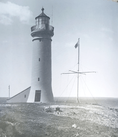
Point Stephens Lighthouse – with a light keeper on the top balcony observing the sea.
The remkander of the articles in the series covered time spent in Newcastle and Lake Macquarie.
Return to Sydney by Cruiser
The Sydney Mail and New South Wales Advertiser, 31 January 1885, page 231, reported the return to Sydney, in the following fashion:
At half past 4 we entered the [Sydney] Heads, and half-an-hour after were partaking of our last dinner on board the Bandicoot, between the Lightship and Bradley’s Head. A few minutes afterwards we had picked up our moorings at Ravenous Bay. The swans were accommodated with pleasant saltwater quarters in a neighbouring bathing-house pending their removal to the National Menagerie. The yacht was relieved of her miscellaneous burthen of pots and pans, and shooting and fishing gear, and a thousand and one other etcetera’s which at the beginning of our cruise made it rather doubtful whether she was not drawing too much water for Lake Macquarie.
Deep maroon is a pale colour compared with the tint of our faces, or at least of two out of the four, as we introduced ourselves to our respective homes, and narrowly escaped being taken for prowling escapees from New Caledonia. But deterioration in the matter of complexion was more than compensated by improvement of appetite and elasticity of spirits won by a three-weeks holiday and unstinted ozone, with plenty of work to give a relish to it, and a happy release during all that time from the pomps and vanities and the cares and duties of humdrum life in Sydney.
There are of course those who prefer to reach their holiday quarters by the rattling snorting locomotive, or to bump their way thither in a buggy over miles of rutty roads, swallowing many peeks of dust in the operation; but my earnest supplications are, first, that I may be allowed to spend another vacation in a cruise to the Myall Lakes, and to linger once more over old haunts before the schnapper has become an extinct fish, and the wild duck and all other “scheduled” birds have concluded to “slope for Texas,” or some other country where they are not protected’ by an Act of Parliament for the benefit of pothunters; and, next, that the glorious yachting resorts I have vainly tried to describe will not remain another year unvisited by the Sydney yachtsman to whom they are now “aquora incognita,” though so easy of access and so devoid of anything like perils of navigation.’
Concluding Comments
The following papers also deal with the areas of Port Stephens and associated subjects covered in this paper. They are published at the following links on the website:
A Scientific Expedition to Port Stephens – 1880
Journey from Maitland to Port Stephens – 1889
A Journey from Port Stephens up the Myall Lakes to Forster – 1908
A River Journey from Bulahdelah to Tea Gardens – 1924
Recreational Shooting at Myall Lakes – An Historical Perspective
Early History of the Timber Industry in the Myall and Port Stephens Areas
Store Boats of the Myall River and Lakes
A History of Broughton Island – Port Stephens
History of Tourism at Port Stephens
Researched and compiled by Kevin McGuinness
November 2025
