
Introduction
The first official land survey of the Port Stephens region in the colonial era was that carried out by the Deputy Surveyor-General, Charles Grimes in 1795.
Many of the earliest recorded maps of Port Stephens were produced by the Australian Agricultural Company, after it had established its farming operations in 1826 at Carrington at the western end of Port Stephens.
This paper compiles a series of twenty-four maps of Port Stephens dating from the early colonial times up until the modern era. They reflect both the topography of the area which would have been so familiar to the original indigenous inhabitants, as well as the economic development of the region as roads and town settlements were opened up by farmers, timber workers and fishermen.
First Survey of Port Stephens – 1795
The Newcastle Morning Herald and Miners’ Advocate of 17 August 1897, page 7, reported on a survey of Port Stephens and other areas by Deputy Surveyor-General, Charles Grimes:
‘The multiplicity of affairs at Sydney rendered the surveys of the harbours or bays along the coast very slow work. About the 3 March 1788, [Captain] Phillip explored Broken Bay, and actually entered the channel of the Hawkesbury River, but had not time to examine it carefully. About the 7 of June 1789, he explored the river, which he named after Lord Hawkesbury, then the head of the Council of Trade and Plantations. Not having traced the river to its source, he set out on the 29th of the same month for “another excursion, which was to last 21 days. He explored the river as far as Richmond Hill.
In January 1794, he established a settlement at the river at a place now known as Windsor, and he caused the Government boats to go up and down the river regularly every week. All this time the northern coast remained unsurveyed, although Lieutenant Shortland’s voyage, which contains a request for the survey of Port Stephens, had been published in 1789, and circulated in the colony in September 1791, by the officers of H.M.S. Gorgon.
It was not until February 1795, that any effort was made to place any of the northern harbours on maps of the colony. In that month Lieutenant Governor Paterson directed the Deputy Surveyor-General, Mr. Charles Grimes, to proceed in the colonial vessel Francis to Port Stephens and survey it. The vessel had for some time previously been running to the Hawkesbury River, in order to supply the settlers on the banks with provisions.
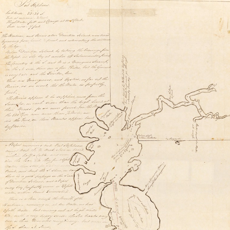
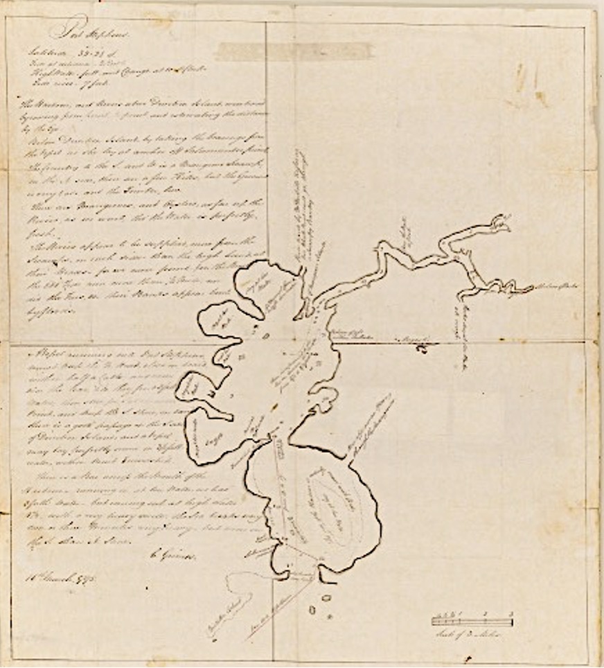
About the 19 February 1795, the Francis left Port Jackson, and reached Port Stephens on the 21st, anchoring at the entrance to the port, near a point which was called Salamander Bay. One week was spent in exploring the port. Colonial Secretary Collins says in his diary: “‘Mr. Grimes reported that he went into two freshwater branches, up which he rowed, until at no very great distance from the entrance he found them terminate in a swamp. He described the land on each side to be very low and sandy, and had seen nothing while in this harbour which, in his opinion, could render a second visit necessary.”
Lieut.-Governor Paterson, writing to the Right Hon. Henry Dundas, from Sydney, under date 21 March 1795, says: “Wishing to obtain some information which I could depend upon respecting the harbour of Port Stephens (30 leagues to the northward of this place) I sent the colonial vessel thither, under the direction of Mr. Grimes, the deputy-surveyor. He remained in it about a week, and from his report I have no reason to conclude that it will ever be necessary to send a second time to it.” According to the plan which accompanied this letter, Mr. Grimes describes “the north side of the harbour as covered with shoals.” He fixes the latitude 32deg 28min S. and records the tide at the entrance as two knots and speaks of high water fall and change at 10 o’clock with a tide which rises 7ft.
He writes: “The country to the south and west is a mangrove swamp. On the north side there are a few hills, but the ground is very bad—sandy and stoney. There are mangroves and oysters growing as far up the river as we could go, though the water is perfectly fresh. The rivers appear to be more supplied from the swamps on each side than from the high land at their heads, for we never found the ebb tide run more than a quarter of a mile, nor did the trees on their banks appear bent by floods.” He found a bar across the mouth of the harbour of three fathoms at low water. The port in appearance resembles a pair of spectacles, and at the centre there is a small island which he called ” Direction Island,” and the south point ” Friendship Point.” One of the rivers was traced by Mr. Nichols (as far as the vessel’s whaleboat would go) through a swampy country.’
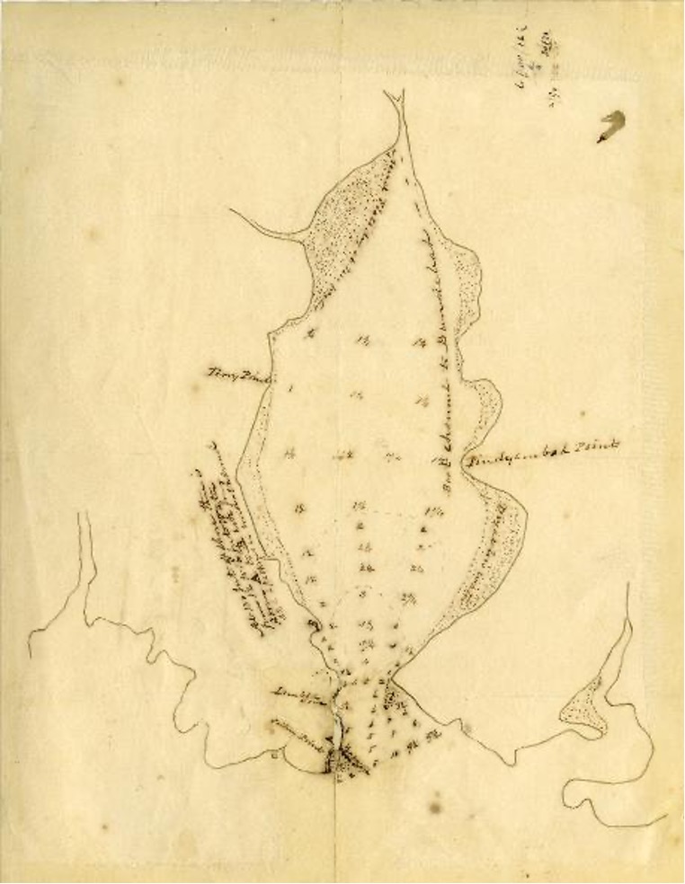
Map of Port Stephens and commentary prepared by Charles Grimes in 1795. The Myall Lakes area had not been explored at this stage. The Tomaree and Yacabba headlands are located at the bottom of the map [State Library NSW]
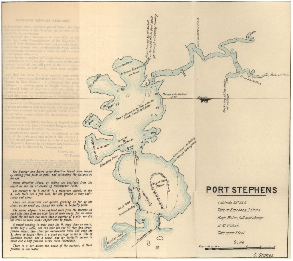
Published version of Charles Grimes’ 1795 Map [Historical Records NSW Vol 2]. Point Stephens (Fingal Island) was named Mistake Island; Soldiers Point was named Friendship Point; and the Little Beach area of Nelson Bay was named Salamander Bay.
Maps of Port Stephens Over Time
Twenty-four maps of Port Stephens covering the period from the 1790’s to 1998 are illustrated below. Each map has its own story and contributes to our knowledge of Port Stephens history.
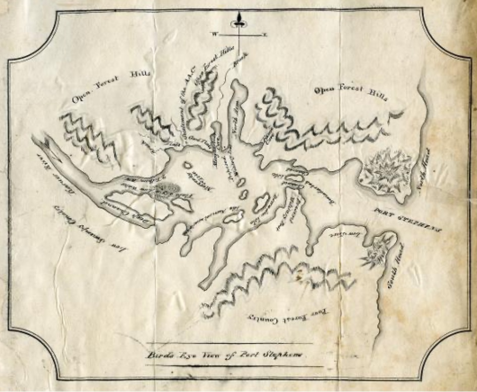
Map 1
Port Stephens, 1790s. Cabbage Tree Island is shown as the second island from the map base. Fingal Beach is shown as Rocky Beach. Soldiers Point is shown as Friendship Point. The Myall Lakes area had not been explored at this stage. The Tomaree and Yacabba headlands are located at the bottom of the map [Natural History Museum, London]
Published version of Charles Grime‘s 1795 Map [Historical Records NSW Vol 2]. Point Stephens (Fingal Island) was named Mistake Island; Soldiers Point was named Friendship Point; and the Little Beach area of Nelson Bay was named Salamander Bay.
Map 2
Port Stephens, 1826. The Australian Agricultural Company settlement is noted at the western end of the harbour. The surrounding hills of the Port Stephens district are evident [Australian National University]
Map 3
Port Stephens, 1826 – a variation of Map 2. The undeveloped hinterland of the district is evident [State Library NSW]
Map 4
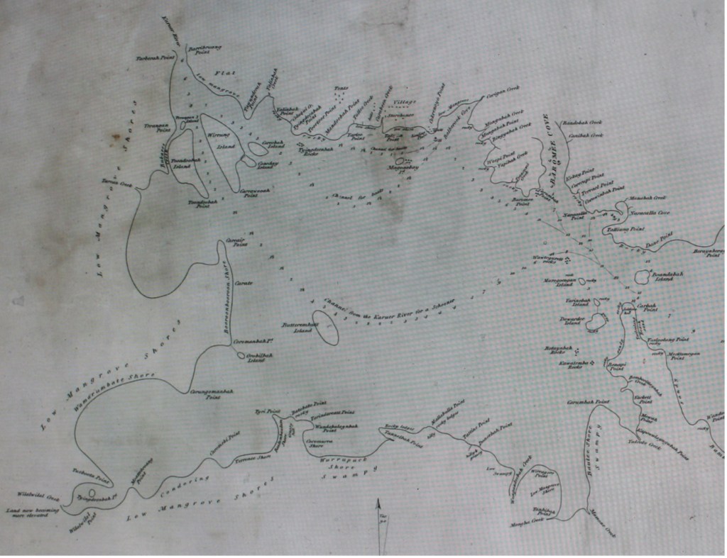
Port Stephens, 1826 – drawn by Henry Thomas Ebsworth [State Library NSW]
The following locations are shown on the above map from both the inner and outer areas of Port Stephens:
At Carrington:
- Mr. Dawsons House
- Convicts Barracks
- Carpenter yards and shops
- Tents
- Church
- Free mechanics
- Emancipists
- Superintendents
- Stores and warehouses
- Dairy
- Military guard house [A. A Co., Boat landing area]
- Naracallah Cove
Rivers
- Karuer River
- Melulyn or Myall River
Creeks
- Yalimbay Creek
- Cologui Creek
- Tarlee Creek
- Bukaree Creek
- Tarean Creek
- Carabeen Creek
- Corrigan Creek
- Onall Creek
- Yarubah Creek
- Boomborillaynbah Creek
- Yulcook Creek
- Mammone Creek
- Mongha Creek
- Wungandeebah Creek
- Wildwelah Creek
- Yammang Creek
- Yulcock Creek
- Yarubah Creek
- Onall Creek
Coves
- Balberook Cove [A. A Co., Boat landing area]
- Naracallah Cove
- Baromee Cove [A. A Co., Boat landing area]
- Naracallah Cove [A. A Co., Boat landing area]
- Naracallah Cove
- Nelson’s Bay [Little Beach] [A. A Co., Boat landing area]
- Naracallah Cove
Heads
- Yahcahbah or North Head
- Toomeree or South Head
Hills
- Cowulobray Hill
- Wahwa Hill
Water Wells
- Omegayn Point
- Toonandeebah Point
Land Points
- Tarberah Point
- Burribruong Point
- Tawunderah Point
- Yaluibah Point
- Tyingdeenbah Point
- Toorloor Point
- Mandoebah Point
- Turlee Point
- Talmun Point
- Cokrenoyo Point
- Yahibah Point
- Mongabah Point
- Weepi Point
- Baromee Point
- Carumbah Point
- Kokay Point
- Corecupah Point
- Tarreal Point
- Naracallah Point
- Tattinng Point
- Dane Point
- Beraynberaynbah Point
- Bolaynbah Point
- Orungal Point
- Nenungan Point
- Cawalinbah Point
- Omegayn Point [Tomaree Head]
- Terambay Point [Nelson Head]
- Toonandeebah Point [Fly Point]
- Breaynbah Point
- Camberre Point [Sandy Point]
- Nanoongale Point [Corlette Point]
- Wandonandah Point [Wanda Head]
- Meckamegan Point
- Carbah Point [Soldiers Point]
- Benapi Point
- Yackett Point
- Monah Point
- Capowulayngubah Point
- Carumbah Point
- Tanhibah Point
- Wirragoro Point
- Doneebah Point
- Iattyn Point
- Mallabullah Point
- Tannelbah Point
- Wundahbay Point
- Tarindareat Point
- Bato Bato Point
- Tyri Point
- Caromebi Point
- Moattebroang Point
- Tueboobah Point
- Corungomanbah Point
- Coromandah Point
- Carate Point
- Careair Point
Beaches and Shores
- Waynderrebah Beach
- Niarrah Beach [Shoal Bay Beach]
- Talkah Beach [Shoal Bay Beach]
- Moroinbah Beach
- Pikelerribah Beach
- Bamboo Beach
- Baulumbaulum Shore
- Wamarumbayt Shore
- Booroombooroom Shore
Islands
- Ierangan Island
- Ioondoobah Island
- Wirrung Island
- Coreebah Island
- Carrawooah Island
- Orobilbah Island
- Butterembutt Island
- Magoenby Island
- Murrogoengan Island
- Yarinabah Island
- Dowardee Island
- Boandabah Island
- Yanayobah Island
- Boandelbah Island
- Tackayang Island
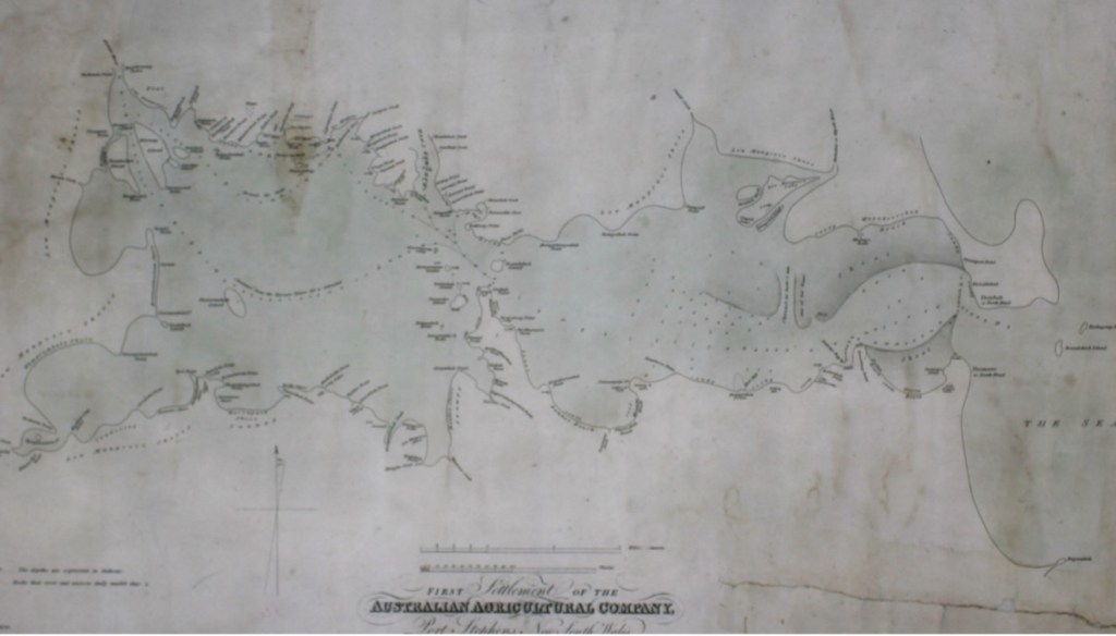
Map 5
First settlement of the Australian Agricultural Company, Port Stephens, 1826 [Australian National University]. Two enlargements of the above map are set out below.
Map 5(a)
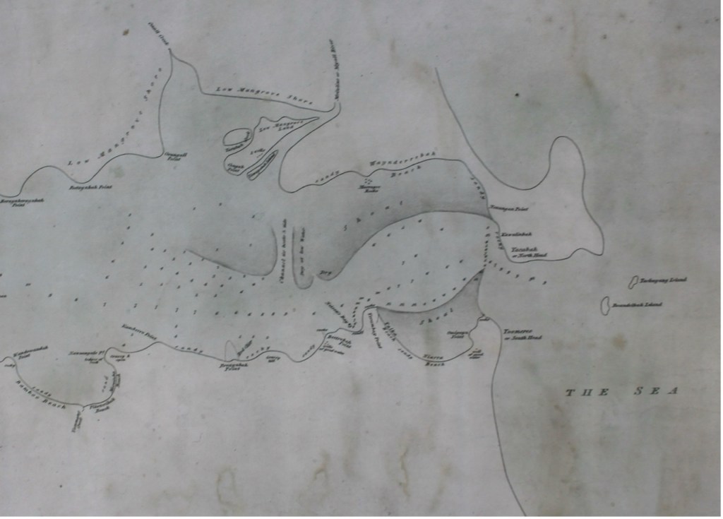
Enlargement of the first settlement map of the Australian Agricultural Company, 1826 showing the area of Port Stephens near the Tomaree and Yacabba Headlands. The shoals that define the navigable channel for the Australian Agricultural Company boats are shown [Australian National University]
Map 5(b)
Enlargement of the first settlement map of the Australian Agricultural Company, 1826 showing the area of Port Stephens near Carrington and Tahlee. The map shows the location of many place names which are no longer used [Australian National University]
Map 6
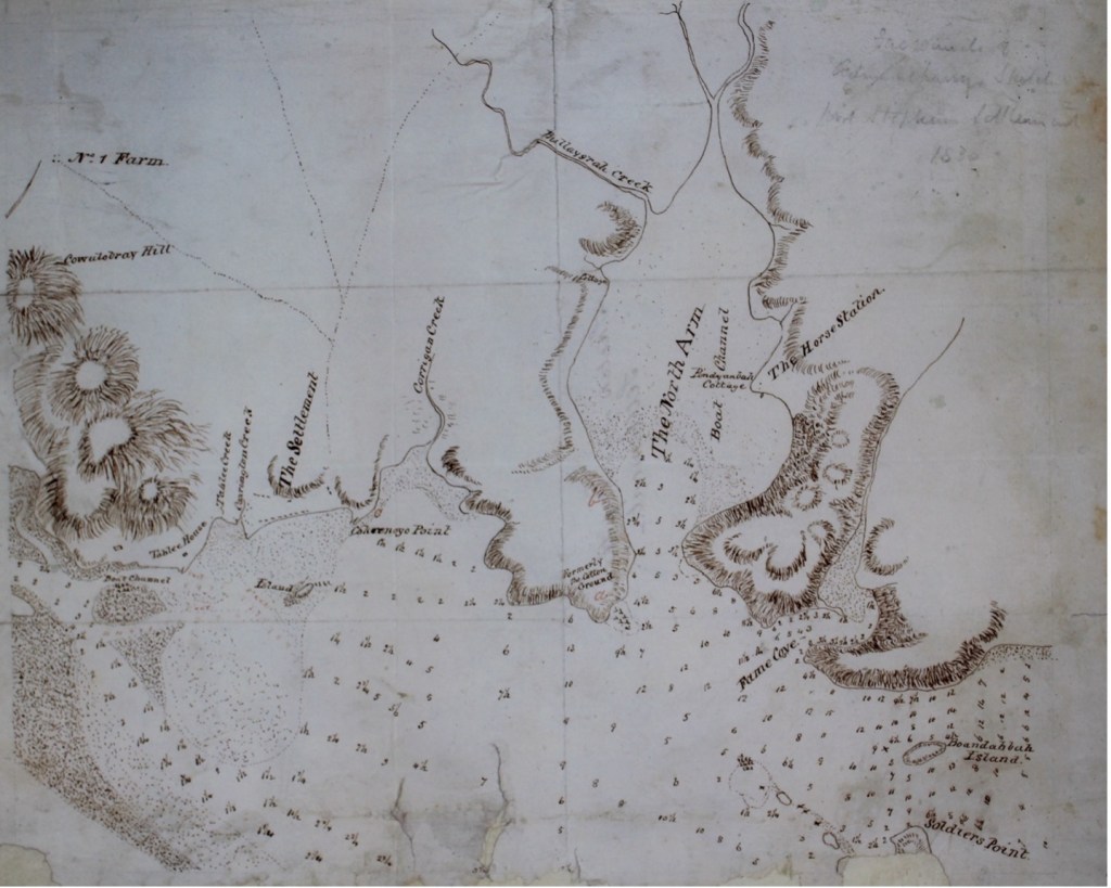
Settlement of the Australian Agricultural Company at Carrington, Port Stephens, circa 1826. The map shows the location of the Horse Station, the former cotton ground, number one farm, Tahlee House and Pindyanbah [Pindimar] Cottage [Australian National University]
Map 7
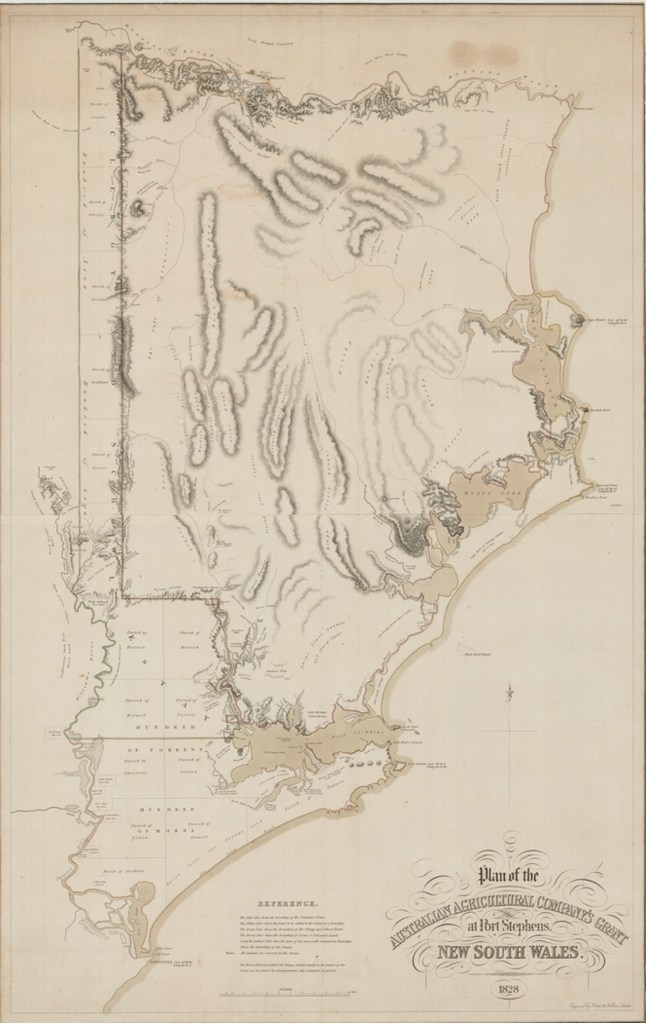
Australian Agricultural Company land at Port Stephens, 1828. The map covers the coast stretching from Newcastle, followed by Port Stephens and Forster and ending at the Hastings River, Port Macquarie [State Library NSW]
Map 8
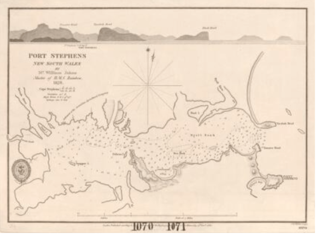
Port Stephens map prepared by William Johns, Master of H.M.S. Rainbow, 1828. The undeveloped state of the Port Stephens area is evident [British Admiralty Charts of Australian Waters,1814-1861]
Map 9
North Arm, Port Stephens, 1828. The surrounding area was subject to considerable speculative land sales in the 1920’s [Australian National University]
Map 10
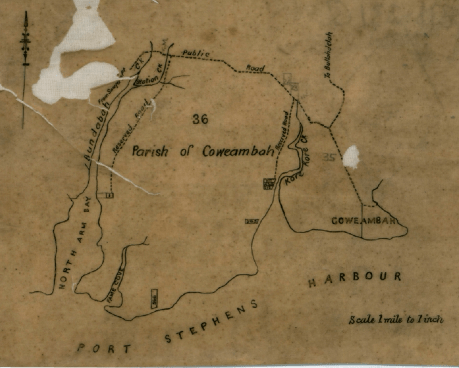
Australian Agricultural Company map of North Arm Bay, Fame Cove and the Coweambah (Tea Gardens) area of Port Stephens [Australian National University]
Map 11
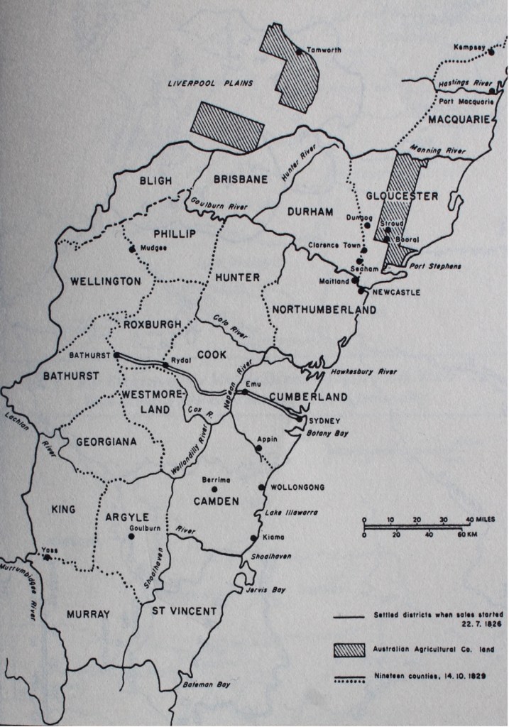
Counties of the middle district of New South Wales, showing Australian Agricultural Land at Port Stephens and elsewhere (hatched) [C. M. H. Clark, A History of Australia, volume 3]
Map 12
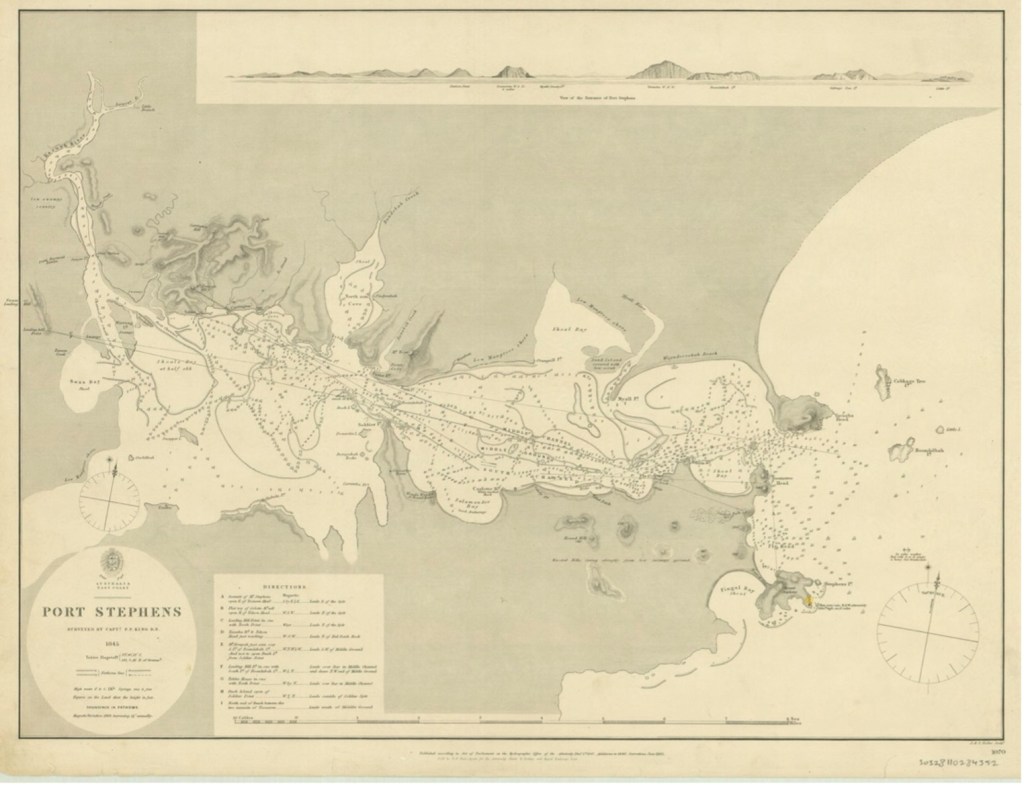
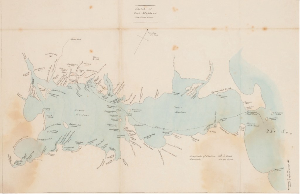
Survey Map of Port Stephens, prepared for Captain P. P. King, R.N., who was then the Commissioner of the Australian Agricultural Company, 1845 [State Library of Victoria]
Map 13
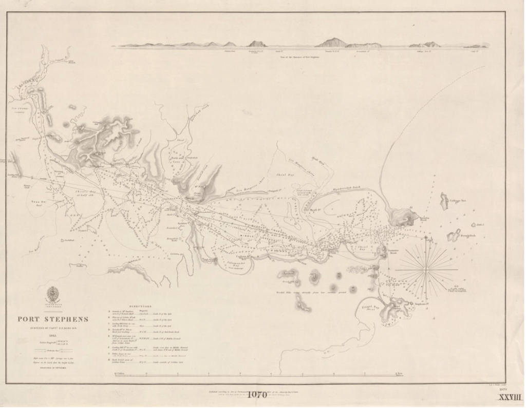
Port Stephens, surveyed by Captain P. P. King, 1847. Similar to previous map [State Library of Victoria]
Map 14
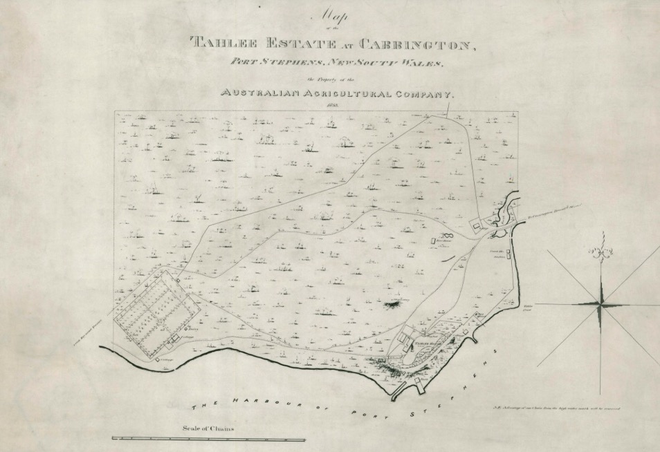
Tahlee Estate at Carrington, Port Stephens, 1853. Tahlee House is located at the bottom of the map. The dairy of the Australian Agricultural Company is located at the bottom of the map to the left of Tahlee House [Australian National University]
Map 15
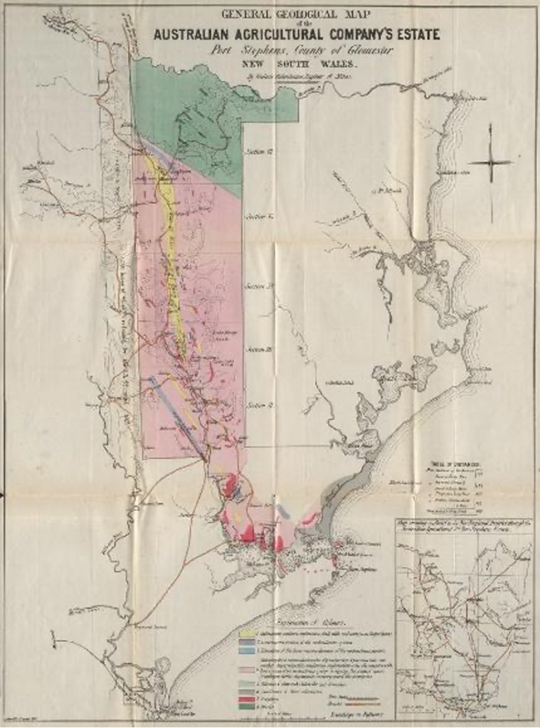
General Geological Map of the Australian Agricultural Company’s Estate, Port Stephens, 1856 [Australian National University]
Map 16
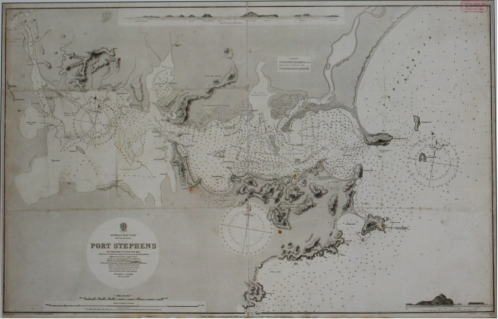
Port Stephens, prepared by Commander F. W. Sidney, R.N., 1866
Map 17
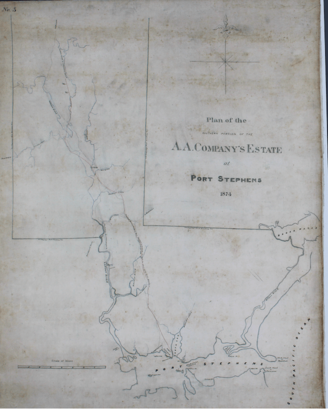
Part of the Australian Agricultural Company Estate, Port Stephens, 1874
Map 18
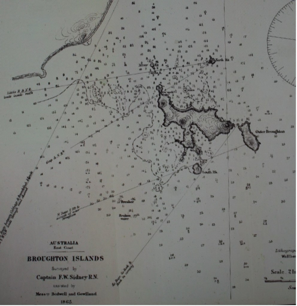
Broughton Island, surveyed by Captain F. W. Sidney, R.N., 1865 [Wellbank’s Australian Nautical Almanac and Coasters Guide, 1874]
Map 19
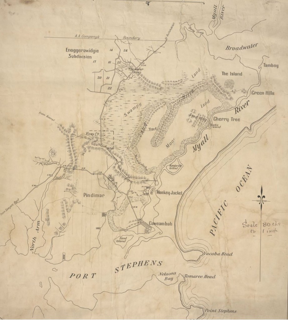
North shore of Port Stephens, circa 1880. Early roads and settlements such as Coweambah (Tea Gardens) are evident [Newcastle Library]
Map 20
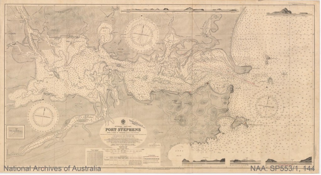
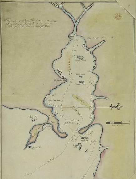
Survey of Port Stephens taken by the ship, Fantome, 1920. [National Archives of Australia] The story of the preparation of this map is found at Port Stephens Survey Map – 1920 on this website.
Map 21
Topographic map of Port Stephens, 1928 [National Library of Australia]
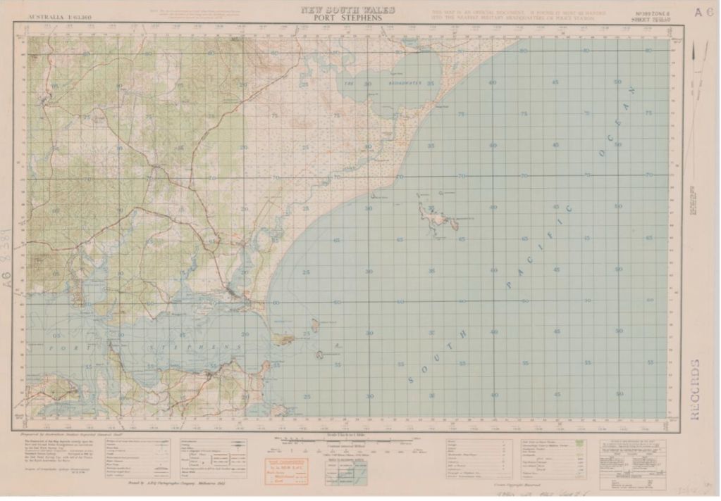
Map 22
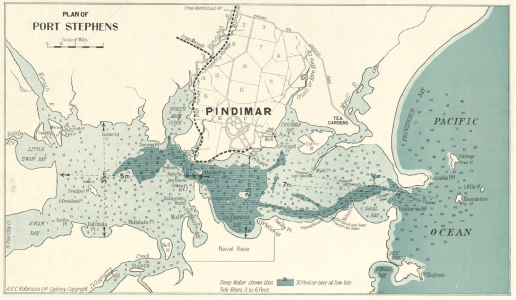
Port Stephens, 1928. The Map features the Pindimar City development on the north side of the harbour and the proposed Naval Base on the southern side. [H.E.C Robinson Ltd., National Library of Australia]
Further information on the Pindimar real estate development is found at the above link on this website.
Map 23
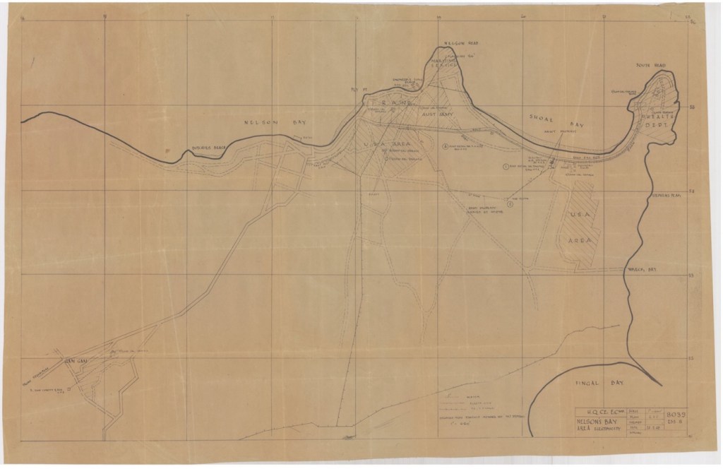
Southern side of Port Stephens, 1948. Second World War military establishments are shown at Nelson Bay and Shoal Bay [University of Newcastle]
Map 24

Map of traditional place names on the Myall Lake and adjoining waterways. Drawn by P. D. (Pete) Graham. [Prepared by Michael Johnson, 1998, and on display at the Inner Light Museum, Nelson Bay]
The following place names, most of which are no longer used, are featured on the above map:
The Broadwater
- Bream Dig
- The Well [Creek and well for freshwater for steam droghers]
- The Roots (White Tree Bay)
- Dees Corner
- Mungo Point
- Blackfellows Bay
- Mungo Corner
- Flea Point
- Sandy Point
- Ripley’s Flat
- Tamboy
- Jokers Island [‘Joker’ Asquith]
- Stoney Point
- Duck Bay
- Log Wharf
- Mill Point
- Coot Bay
- S-tpot Bay
- Bulahdelah Point
- Lovers Walk
- Bandicoot Point
- Reedy Point
- Sugar Point
- The Rocks
- Home Dig
- Bombah Point
Two Mile and Narrows
- Ranso’s Point [‘Ranso’ Bramble]
- Mud Run
- Professor’s Cove [Professor Ratcliffe]
- Henrys Point [Henry Johnson
- Freshwater
- Taits
- Dickenson’s Wharf (Brambles)
- Joes Cove [Allan Joseph Smith Memorial]
- Reedy Point
- Legges
- Echo Bay
- Billy Irelands
- Nosworths
- Woodbox Bay
- Korsmans
- Pat McGraths
- Wallaby Joe’s Bay [Joe Louis, American Negro]
- Mackaway Bay
- Clarkes Bay (Sunnyside)
- Crolls Bay
Boolambayte Lake and Doolys Channel
- Wears Bay
- The Ranch [Dick Legges farm]
- Smiths Hill
- Bungaree Bay
- Violet Hill
- Bonnys
- Bonny’s Bay
- Johnsons Beach
- The Block [Johnsons crown lease block]
- Teddy’s Flat [Teddy Bramble]
- Swan Pens [Harry Legges swan pen]
- Korsmans Sands
- Pidgeon Point
- Goat Island
- Sheep Island
- Old Farm Flat
- Old Farm House
- Thomas Bay
- Dookies Corner [‘Dookie’ Asquith]
- Short Cut
- Lemon Tree Point
Myall Lake and Russell’s Bay
- Tickerabit
- Tickerabit Sands
- Ranny’s Yard [Randolph Bonny (bullock yard)]
- Palmers Bay
- Shelley Beach
- Shelley Point
- Palmers Sands
- Blossom Point Bay
- Blossom Point
- Long Point Bay
- Long Point
- Half Way Tea Tree
- Limestone Cave
- Bibby Harbour
- Kattaway
- Kattaway Reef
- Kattaway House
- Kattaway Bay
- Buckmans Camp
- Buckmans Flat
- One Tea Tree
- Roll down [Roll down logs to lake shore]
- Big Flat
- Little Lake
- Neranie Hill
- Hearts [Log hearts from timber mill]
- Stewards Wharf
- Neranie Bay
- Lamins Point
- Bungwahl
- Crolls Flat
- Swimming Hole
- Corrigan’s Point
- Corrigan’s Island
- Thunderbolt [Frederick Ward (Thunderbolt), bushranger, camped here]
- Flat Rock
- Rabbit Point
- Burrah Burrah Peak
- Fence
- Daddy’s Sandy Landing Reef
- Daddy’s Sandy Landing [‘Daddy’ William Bramble]
- Flat Rock
- Bowlers Rock [‘Bowler’ Asquith]
- The Cow Died
- Fig Tree
- Dairy Point
- Upper house
- Russell Reef
- Davis Camp
- Stinging Tree
- Corrigans Reef
- Stag Island (Toms)
- Stick Rock
- Little Island
- Gnahpeang
- Bare Patch
- Rock Bay
- The Rock
- Mill Bay
- Mayers Point
- Crolls Wharf
- Mayers Bay
- McGraths
- Limestone wharf
- Newton’s Wharf
- Hewitts Creek
- Hewitts
- McRaes Corner
- Andersons Wharf
- Pats Head
- McGrath’s Bay
- Clydes Wharf [Clyde McGrath]
- Fish Trap
- Swan Point
- Pretty Flat Bay
- Pretty Flat
- Steep Wharf
- Dunns Fence
- Bulls Bay
- McGraths Island
- Johnson’s Island
- Bird Island
- Double Island
Concluding Comments
The twenty-four maps illustrate the geographical history of Port Stephens as recorded from the early colonial times up until the modern era.
The earlier maps illustrate the Port Stephens area in its natural state, with hills and marshes, as the local aboriginal inhabitants would have been very familiar with.
Later maps show the earliest farming operations undertaken by the Australian Agricultural Company, followed later by the development of roads and town settlements as the area was opened up by farmers, timber workers and fishermen.
Researched and compiled by Kevin McGuinness
September 2024
