

Introduction
The Port Stephens harbour is a drowned valley. In the distant past, it is believed that there was a general subsidence of some 400 feet in the land, which allowed the lower parts of the valley to be drowned by the sea which flooded the low-lands.
The tops of the former high ridges in the earlier landscape, now form the various islands within the Port Stephens harbour and those situated off its immediate coast.
Since the 1850’s, the following two significant changes to the physical landscape have occurred in the Port Stephens area: viz
- The vanishing of Myall Point within the harbour; and
- Removal of Narrow Gut, a peninsular of land connecting the mainland with Point Stephens (where the outer lighthouse stands), by the Maitland Gale of 1898.
This paper reviews these two changed landscapes.
The Vanishing Myall Point
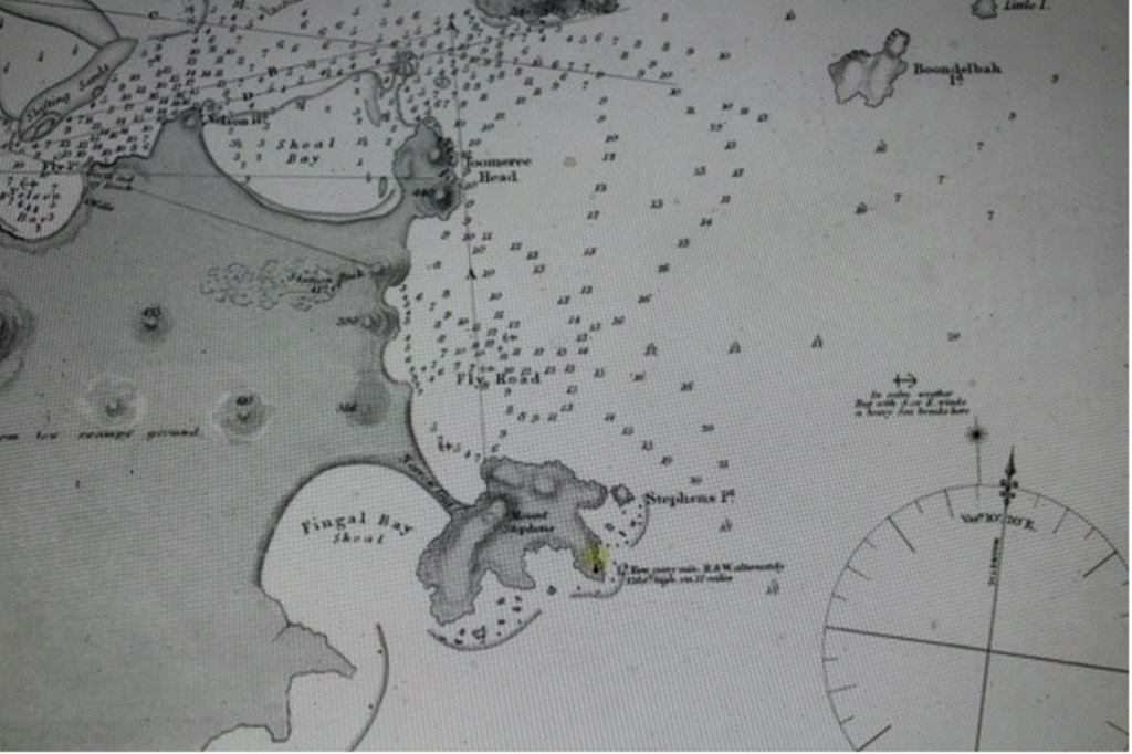
On the 1845 survey map of Port Stephens, complied by Captain P. P. King, R.N., Myall Point is clearly shown jutting into the Port Stephens harbour, opposite Nelson Bay. This was a vegetated peninsula that stretched from the western tip of Winda Woppa, near Tea Gardens, running parallel to and below Corrie Island near the mouth of the Myall River (opposite Nelson Bay). It appears on maps of Port Stephens from 1845.
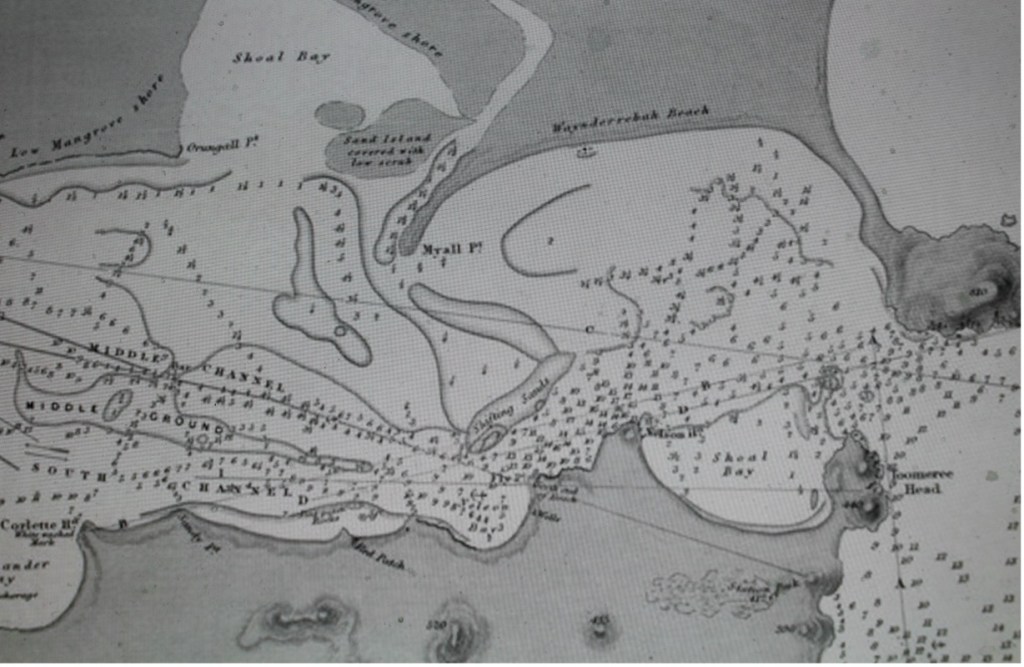
Area of the 1845 Survey Map of Port Stephens showing Myall Point (centre of map) within the Port Stephens harbour [State Library of Victoria]
The following section of the Port Stephens Survey Map 1920 also shows Myall Point, where it is described as a ‘low sand point covered with small scrub’.
Further details of the compilation of the Port Stephens Survey Map 1920 are found at this link on the website.
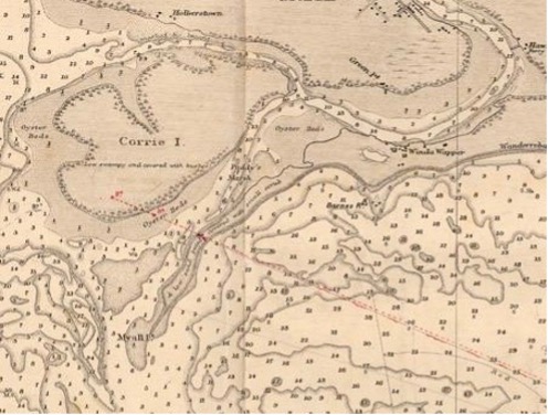
Area of 1920 Survey Map showing Myall Point (centre of map) [National Archives of Australia]
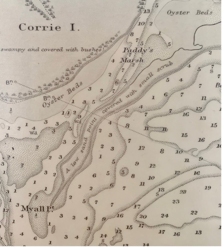
Area of Myall Point as designated on the 1920 Survey Map
Today Myall Point as a land feature has vanished, having succumbed to dredging, a change in tidal patterns and a ferocious storm in 1927.
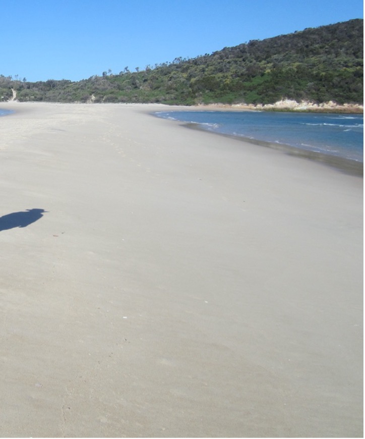
It is marked on modern maritime maps as a ‘sandy shoal’ named Paddy Marr’s Bar (formerly Paddy’s Marsh). It is hazardous to boating.
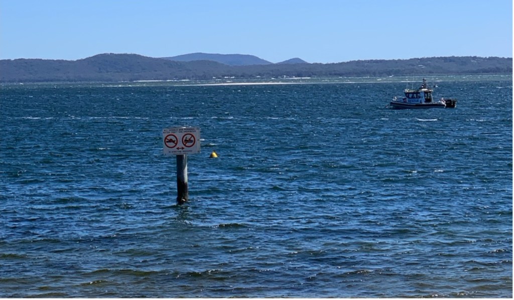
The sand bar visible towards the top of the above photo taken from Little Beach, Nelson Bay, shows the location of the former Myall Point [Author photo]
The Narrow Gut
On the 5 and 6 May 1898, a huge gale blew along the New South Wales coast and for a distance inland. It was of such intensity that it caused much destruction including damage to ships at sea and resulted in at least 32 deaths.
In addition, several ships that sought shelter in Port Stephens, found that the usually safe harbour, did not provide sufficient protection on this occasion.
Known as the Maitland Gale, the full story is found at the this link on the website.
Area of the 1845 Survey Map of Port Stephens showing Narrow Gut connecting the mainland withy Point Stephens [State Library of Victoria]
At Port Stephens, the gale permanently removed Narrow Gut which was a large stretch of a sand bar with vegetation. It had provided a safe trafficable track between the mainland and the Point Stephens lighthouse.
From then on, all supplies for the lighthouse staff had to be conveyed by boat. All that remains today in place is a low-level spit of sand that can only be traversed at low tide.
The sand spit is dangerous if an attempt is made to cross it while submerged, as a strong current flows across it. There have been many deaths on this dangerous spit of sand.
The sand spit connecting the mainland with Point Stephens on which the outer lighthouse is situated [Author photo]
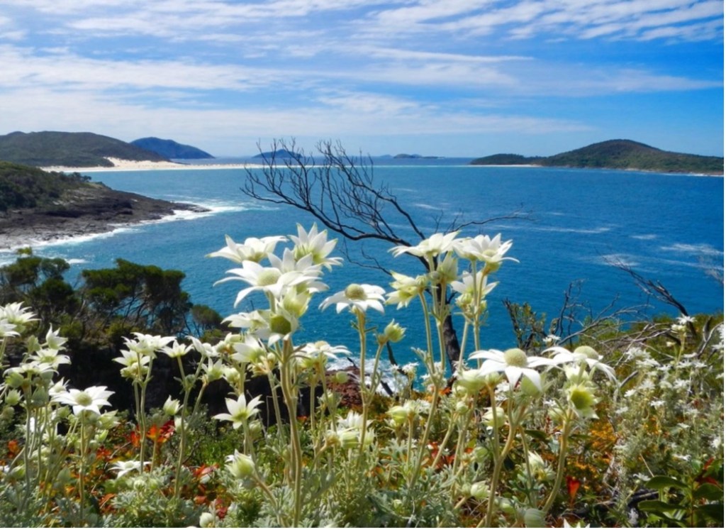
A picturesque view of the sand spit in the distance connecting the mainland with Point Stephens, taken from Barry Park, Shoal Bay (Author photo]
The sand spit which currently provides walking access to the outer lighthouse situated on Point Stephens, is periodically removed by large storms. One example of storm damage is highlighted below.
The Maitland Daily Mercury of 8 August 1912, page 6, reported:
‘Point Stephens, the headland immediately to the southward of the Port Stephens entrance, is now an island, having been cut off from the mainland during the recent heavy weather. The long sand spit or “narrow gut,” as it is officially known, which for years has been the connecting link, yielded to the smashing seas, and according to a report which Captain Hacking, Superintendent of Navigation, has received there is now a channel carrying 8 feet of water at low tide, and of sufficient, width to allow a shallow draught vessel to pass through. It was possible to walk across “the gut’ dry-shod prior to the heavy weather, and it was constantly used by persons on horseback.
The light-keepers lately experienced great trouble in landing their stores, as the little boat harbour was destroyed by the seas. To overcome the difficulty the Navigation Department hired a launch from Nelson’s Bay, but it is now proposed to build a boat which will be suitable for working the landing-place. She will be of light construction, and capable of easy manipulation. The Solitary Island jetty, which was also damaged by the storm, is now being repaired. The principal light-keeper, in his report states that gallons of water poured from the balcony of the tower. The seas smashed clean over the southern end of the island, and completely severed the crane on the western side. The balcony is about 190 feet from the water’s edge, and to the top of the crane it is quite 60 feet.’
Concluding Comments
The Port Stephens harbour is under constant change. Regularly storms move large amounts of sand around areas of the harbour and also erode parts of the shoreline.
The Myall River and Myall Lakes are also similarly subject to changes in the landscape. Over the years, some dredging has been required to maintain shipping channels.
Researched and compiled by Kevin McGuinness
August 2024
