

Introduction
In 1967, the Tourist Organisation of Port Stephens (TOPS) was formed by a group of local business people who were interested in promoting tourism in the area. Its activities including the undertaking of tourist promotions in Sydney and other regions, the opening of a Visitor Information Centre, and the production of promotional material.
In 1997 TOPS was replaced by Port Stephens Tourism Limited [PSTL], a joint venture between business members and the Port Stephens Shire Council.
One of the publications of TOPS, was a brochure setting out the route of a tourist drive around the Tomaree Peninsula area of Port Stephens. It was published in 1987.
In conjunction with the brochure, route markings were placed on poles at intervals around the drive circuit to guide motorists.
The tourist drive has not been promoted for many years and many of the markers are now missing. Those that remain are faded and no longer are clear.
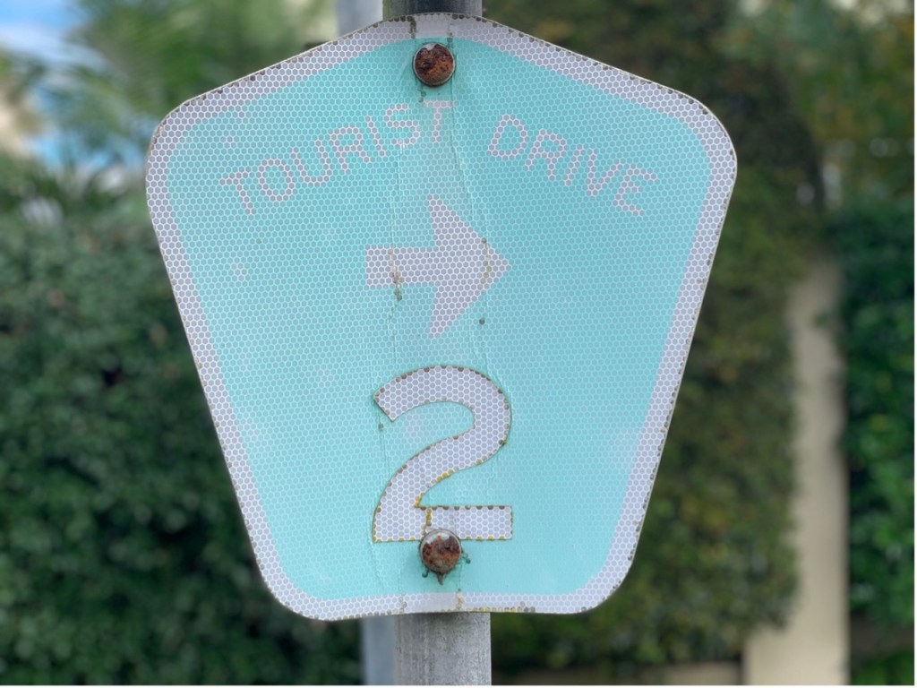
A faded Tourist Route sign on Port Stephens Drive opposite Foreshore Drive [Author photo]
Tourist Drive Brochure
The driving instructions and the attractions to see along the way are reproduced below from the Tourist Drive Brochure, as a matter of historical record:
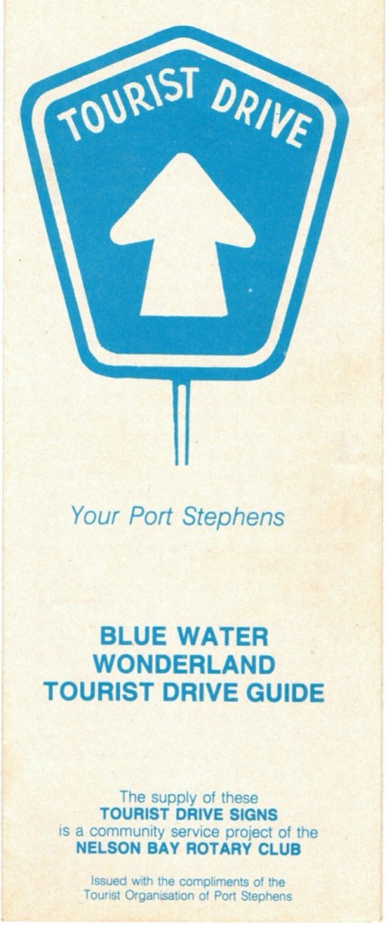
Front overleaf of the brochure
‘This “Tourist Drive” Brochure has been prepared by the Tourist Organisation of Port Stephens to familiarize our visitors with the beauties of the Peninsula area and we sincerely hope that it will be of assistance to our visitors.
Commencing drive at the Cnr. of Stockton Road and Victoria Parade, Nelson Bay, proceed along Nelson Bay Beachfront towards Shoal Bay. DO NOT take the Shoal Bay Road turn, but keep going along Victoria Parade.

The driving route as per brochure.
On your left you will obtain beautiful views of the waterways. At the top the hill, there is a drive off area where you can park to enjoy further views, looking across to Hawks Nest to Winda Woppa.
Continue on to Little Beach, past the Halifax Caravan Park on your left, then into Gowrie Avenue. Turn left into Shoal Bay Road.
As you travel along this road you will notice on your right a bushland area. This is part of the sandbed water supply controlled by the Hunter District Water Board and from which the water supply for the Peninsula is obtained.
As you reach the first houses on your right, expansive views of Shoal Bay and the two headlands which guard the entrance to Port Stephens can be enjoyed The northern headland is Yacaaba Mountain which is 217 metres (712 ft) above sea level, and of the southern side is Tomaree Mountain which is 161 metres (528ft) above sea level.
Driving through Shoal Bay you will see a very modern shopping centre providing all facilities. Shoal Bay is the home of the Newcastle – Port Stephens Game Fish Club and during the peak fishing season you can view the “weighing in” of catches of marlin and shark as the boats arrive back at the wharf after a days game fishing.
A diversion drive may be taken here. Continuing along the waterfront, you finally come to the gateway leading into the Tomaree Holiday Lodge. (Sorry, but no one is allowed past this gate). Park your car here and walk across the sandhills to Zenith Beach. Unless you are a particularly strong swimmer, bathing is not advised.
Return from Zenith Beach the same way and turn left into Tomaree Road (just before Country Club Hotel). As you travel towards Fingal Bay along Tomaree Road, you may care to take two other diversionary drives.
Look out for Verona Road on the left. Park your car at the end of this road and walk along the bush track which will take you to Wreck Beach.
Then further along Tomaree Road turn to the left into an earth road which takes you to Box Beach. As with Zenith Beach, swimming is not recommended at Wreck of Box Beaches.
Continue along Tomaree Road towards Fingal Bay. If you would like to see a panoramic view of this delightful spot, turn right into Lentara Street (just past the first three houses on the right as you enter Fingal Bay) then right into Guruwa Street and on up to the end of this street. Fingal Bay is on the ocean and good surfing can be had. The beach is patrolled by the Surf Life Saving Club.
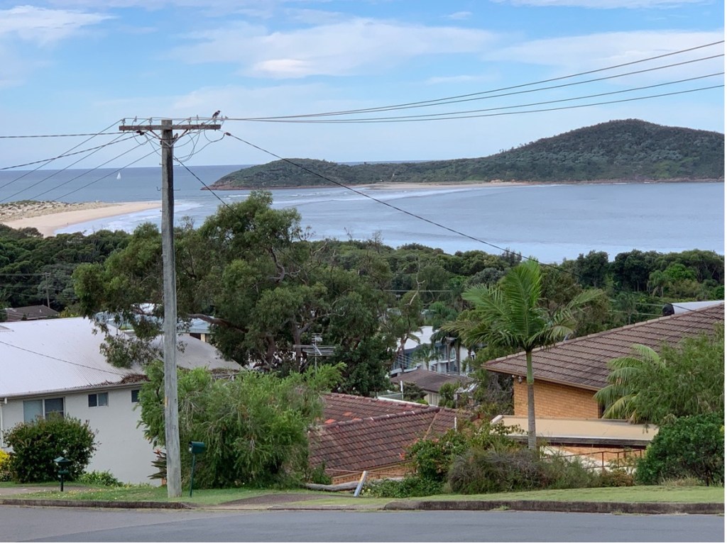
Panamoric view from Guruwa Street, Fingal Bay Author photo -April 2022].
Another vantage point to this is along Marine Drive towards the Headland, veering to the left into a track and driving to a picnic/BBQ area.
Returning from Fingal Bay to Nelson Bay pass through Shoal Bay and instead of turning right into Gowie Avenue, continue along Shoal Bay Road passing the Gemstone House, the Nelson Bay RSL Club, the Nelson Bay High School and the Putt Putt course.
Commencing drive at the corner of Stockton Road and Government Road, proceed past the Nelson Bay Police Station.
A diversionary drive may be taken at Nelson Street, by turning right into Nelson Street then into Thurlow Avenue. This will take you down to Dutchman’s Bay which is a delightful spot with safe swimming for the very young.
Return to Government Road via the same way and turn right, continuing on past Bagnall’s Beach where there are well equipped amenity blocks and picnic areas.
You then come to Corlette where there is a Post Office and General Store. As you pass through Corlette, you will see the Shell Museum on your right.
Entering Salamander Bay, your route takes you around Wanda Head where you may obtain views of the waterways looking east towards the headlands.
Continue on to Soldiers Point and through the township right out to the end of the Peninsula. Looking west you will see the vast expanse of the waterways where the well known Port Stephens oysters are grown to maturity. Middle Island is close to you at this stage. Some of the deepest water in Port Stephens is between the mainland and the island with depths of up to 40m.
To continue your drive return along the same road driving through Salamander township. Follow your Tourist Drive signs and you will pass by the light industrial area in Muller Road.
Turning right from Muller Road you will be driving through natural bush country. You may care to turn right off this road into Taylors Beach and a little way along this road you will see the turnoff to the Brackish Water Fish Research Station.
Back on to Soldiers Point Road, you will finally come to the main Nelson Bay Road “T” intersection. Turn left onto this then after about 400m, turn right onto the Anna Bay Road.
From this road you can take diversionary drives to Birubi Point, Fishermans Bay and Boat Harbour. All these areas have something for the site seeing holiday maker, rock fishing, swimming or rock climbing.
Just pass the Boat Harbour turnoff you will see the sign to One Mile Beach. This is a very safe surfing beach and the entrance to this spot is right next to the Sandfort Caravan Park. The northern end of One Mile Beach, past Samurai Point, is the official nude bathing beach for the Port Stephens area. There are several walking tracks to this area which are shown on the map.
As you proceed north, you finally join up with the main road into Nelson Bay. No drive would be complete without a drive up to the Gan Gan Lookout. Just before you reach the houses on the outskirts of Nelson Bay, you will see the turnoff to the lookout on the left.
Proceed up this road with caution as it is very narrow. It is not advisable to drive cars with caravans attached. When you arrive at the top, park your car, then walk along the path beside the Repeater Station to the rocky lookout area. Here you will be rewarded with a most magnificent view. You will see the full extent of the waterways of Port Stephens, the islands out to sea and looking south on a clear day Newcastle can be seen.
Concluding Comments
An examination of the brochure reveals some of the changes that have occurred since it was published in 1987. Firstly, some roads have been renamed. For example, the map refers to Soldiers Point Road which is now Port Stephens Drive. The tarred road to the present day Barry Park at Fingal Bay, is referred to as a dirt track.
Some attractions no longer exist, such as the Gemstone House, Nelson Bay High School, and the Putt Putt course in Shoal Bay Road, Nelson Bay.
The Tourist Route still remains an excellent way to view the key attractions of the Tomaree Peninsula area of Port Stephens.
Prepared by Kevin McGuinness
May 2022
